Near Perryville in Boyle County, Kentucky — The American South (East South Central)
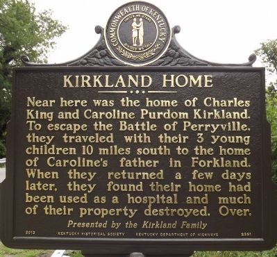
Kirkland Home
Presented By the Kirkland Family
Over
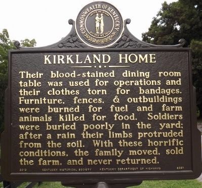
(Reverse)
Their blood-stained dining room table was used for operations and their clothes torn for bandages. Furniture, fences, & outbuildings were burned for fuel and farm animals killed for food. Soldiers were buried poorly in the yard; after a rain their limbs protruded from the soil. With these horrific conditions, the family moved, sold the farm, and never returned.
Erected 2013 by Kentucky Historical Society & Kentucky Department of Highways. (Marker Number 2391.)
Topics and series. This historical marker is listed in this topic list: War, US Civil. In addition, it is included in the Kentucky Historical Society series list.
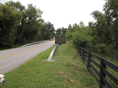
Location. 37° 40.34′ N, 84° 57.775′ W. Marker is near Perryville, Kentucky, in Boyle County. Marker is on Battlefield Road (County Route 1920) south of Whites Road, on the left when traveling south. Touch for map. Marker is at or near this postal address: 1470 Battlefield Road, Perryville KY 40468, United States of America. Touch for directions.
Other nearby markers. At least 8 other markers are within walking distance of this marker. Lumsden's Battery (approx. 0.3 miles away); Battle of Perryville (approx. 0.3 miles away); The Opening Attack (approx. 0.3 miles away); Sgt. Harris B. Cope Memorial (approx. 0.3 miles away); Donelson's Advance (approx. 0.3 miles away); The Valley of Death (approx. 0.3 miles away); Introduction (approx. 0.4 miles away); Soldiers' Reaction to Lincoln's Emancipation (approx. 0.4 miles away). Touch for a list and map of all markers in Perryville.
Credits. This page was last revised on June 16, 2016. It was originally submitted on September 2, 2013, by Ken Smith of Milan, Tennessee. This page has been viewed 730 times since then and 28 times this year. Photos: 1, 2, 3. submitted on September 2, 2013, by Ken Smith of Milan, Tennessee. • Al Wolf was the editor who published this page.


