Bristow in Prince William County, Virginia — The American South (Mid-Atlantic)
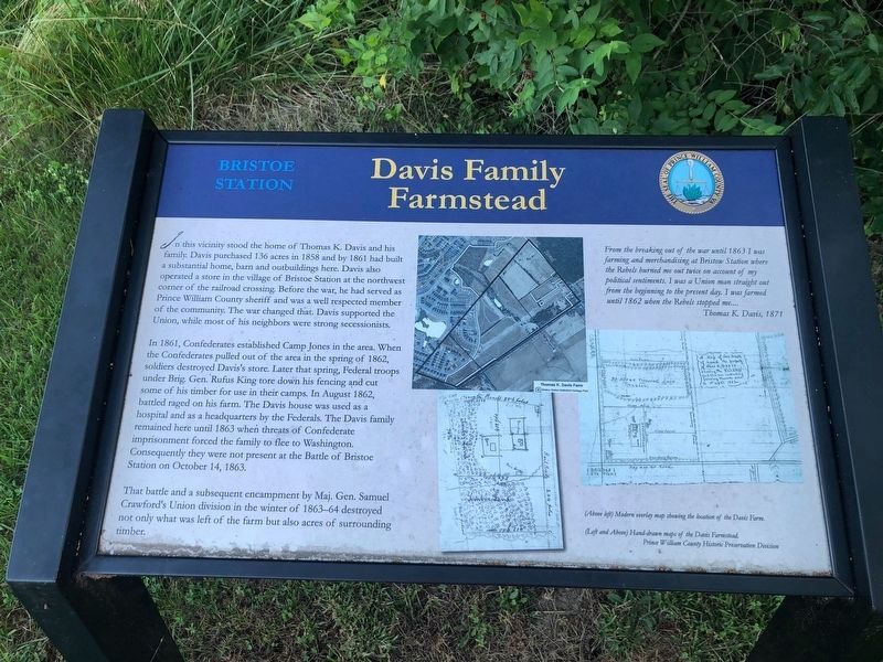
Davis Family Farmstead
Bristoe Station
In 1861, Confederates established Camp Jones in the area. When the Confederates pulled out of the area in the spring of 1862, soldiers destroyed Davis’s store. Later that spring, Federal troops under Brig. Gen. Rufus King tore down his fencing and cut some of his timber for use in their camps. In August 1862, battle raged on his farm. The Davis house was used as a hospital and as a headquarters by the Federals. The Davis family remained here until 1863 when threats of Confederate imprisonment forced the family to flee to Washington. Consequently they were not present at the Battle of Bristoe Station on October 14, 1863.
That battle and a subsequent encampment by Maj. Gen. Samuel Crawford’s Union division in the winter of 1863-64 destroyed not only what was left of the farm but also acres of surrounding timber.
From the breaking out of the war until 1863 I was farming and merchandising at Bristow Station where the Rebels burned me out twice on account of my political sentiments. I was a Union man straight out from the beginning to the present day. I farmed until 1862 when the Rebels stopped me… Thomas K. Davis, 1871
Erected 2013 by Prince William County Department of Public Works, Historic Preservation Division.
Topics. This historical marker is listed in this topic list: War, US Civil. A significant historical date for this entry is October 14, 1863.
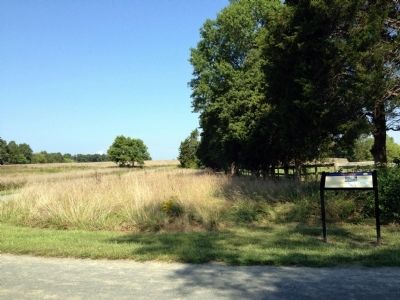
Location. 38° 43.391′ N, 77° 32.42′ W. Marker is in Bristow, Virginia, in Prince William County. Marker can be reached from 10th Alabama Way, 0.3 miles south of Iron Brigade Unit Avenue (Virginia Route 619), on the left when traveling south. Marker is located at Bristoe Station Battlefield Heritage Park. Touch for map. Marker is at or near this postal address: 11619 Iron Brigade Unit Ave, Bristow VA 20136, United States of America. Touch for directions.
Other nearby markers. At least 8 other markers are within walking distance of this marker. "We are in hell and fire on all sides" (about 400 feet away, measured in a direct line); "I Expect We Had Better Charge" (about 500 feet away); Fight for a Pine Thicket (about 600 feet away); The "Tigers" of Louisiana (approx. 0.2 miles away); “We Shall Bag the Whole Crowd” (approx. 0.2 miles away); Deadly Day for Excelsior Brigade (approx. 0.2 miles away); "We Have Never Blushed Before" (approx. ¼ mile away); Battle Along the Railroad (approx. ¼ mile away). Touch for a list and map of all markers in Bristow.
More about this marker. The marker displays three maps captioned (Above left) Modern overlay map showing the location of the Davis Farm. and (Left and Above) Hand-drawn maps of the Davis Farmstead. Prince William County Historic Preservation Division
Also see . . . Bristoe Station Battlefield. Prince William County Public Works. (Submitted on September 9, 2013.)
Credits. This page was last revised on June 13, 2020. It was originally submitted on September 7, 2013. This page has been viewed 892 times since then and 80 times this year. Photos: 1. submitted on June 13, 2020, by Devry Becker Jones of Washington, District of Columbia. 2. submitted on September 7, 2013. • Bernard Fisher was the editor who published this page.

