Harmony in San Luis Obispo County, California — The American West (Pacific Coastal)
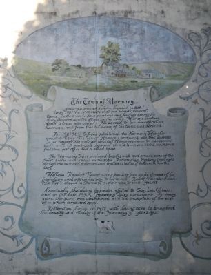
The Town of Harmony
....grew up around a dairy, founded in 1869. Until 1907 the creamery changed hands several times. In these early days rivalries and feuding among the dairy farmers caused chaos in the valley. After one shooting death a truce was called. All agreed to live henceforth in harmony, and from this the name of the towne was derived.
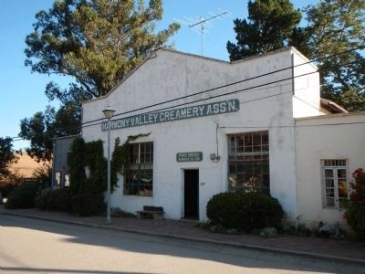
In 1907 M.D. Salmina established the Harmony Valley Cooperative Dairy. The town of Harmony prospered with this business. In its heyday the village boasted a large residence for management, bunkhouses for employees, a general store, a livery and stable, blacksmith, feed store, post office and a school house. The Harmony Dairy produced besides milk and cream, some of the finest butter and cheese in the state. In those days, Highway 1 ran right through the town and motorists were treated to ladles of buttermilk form the dairy.
William Randolf Hearst was a familiar face as he stopped off for fresh dairy products on his way to his ranch. Rudolf Valentino and Pola Negri stopped in Harmony on their way to visit Hearst.
Eventually the dairy business shifted to San Luis Obispo, and in the late 1950s Harmony Dairy was closed. For many years the town was abandoned with the exception of the post office which remained open.
Restoration began in 1972, with loving care, to bring back the beauty and vitality of the Harmony of years ago.
Topics. This historical marker is listed in these topic lists: Agriculture • Notable Places. A significant historical year for this entry is 1869.
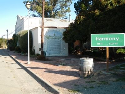
Location. 35° 30.517′ N, 121° 1.37′ W. Marker is in Harmony, California, in San Luis Obispo County. Marker is on Old Creamery Road west of Harmony Valley Road, on the right when traveling west. Touch for map. Marker is at or near this postal address: 2111 Old Creamery Road, Harmony CA 93435, United States of America. Touch for directions.
Other nearby markers. At least 8 other markers are within 13 miles of this marker, measured as the crow flies. Preserving a Bit of History (approx. 5 miles away); Cambria Veterans' Memorial (approx. 5.7 miles away); Piedras Blancas Lighthouse Lens (approx. 5.7 miles away); Nitt Witt Ridge (approx. 5.9 miles away); Home of Capt. James Cass (approx. 7.7 miles away); Cayucos by the Sea (approx. 7.8 miles away); Willow Creek Mennonite Church (approx. 12.6 miles away); Adelaida (approx. 12.7 miles away).
Credits. This page was last revised on June 16, 2016. It was originally submitted on September 8, 2013, by Barry Swackhamer of Brentwood, California. This page has been viewed 648 times since then and 46 times this year. Photos: 1, 2, 3. submitted on September 8, 2013, by Barry Swackhamer of Brentwood, California. • Syd Whittle was the editor who published this page.


