Lodi in Seneca County, New York — The American Northeast (Mid-Atlantic)
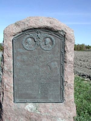
Routes of the armies of General John Sullivan and General James Clinton
1779
Erected 1929 by New York State.
Topics and series. This memorial is listed in these topic lists: Native Americans • War, US Revolutionary. In addition, it is included in the The Sullivan-Clinton Expedition Against the Iroquois Indians series list.
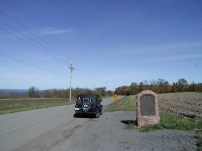
Location. 42° 34.934′ N, 76° 51.388′ W. Marker is in Lodi, New York, in Seneca County. Memorial is on Rhodes Road just west of New York State Route 414, on the right when traveling west. Marker is on a dirt road off the main road. While the view of Seneca Lake is spectacular, unless you're specifically looking for markers, you probably would not notice this one. The vast majority of the other markers in this series are at a site where something specific happened. This marker has no indication of what the reason for this specific site is. Touch for map. Marker is in this post office area: Lodi NY 14860, United States of America. Touch for directions.
Other nearby markers. At least 8 other markers are within 6 miles of this marker, measured as the crow flies. Silas Halsey (1743 - 1832) (approx. 3 miles away); Con-Daw-Haw (approx. 3.2 miles away); Ferry (approx. 3.3 miles away); The Finger Lakes (approx. 5.1 miles away); Early Settler (approx. 5˝ miles away); Peach Orchard (approx. 5.6 miles away); First Presbyterian Church (approx. 5.7 miles away); Gen. Hand's Light Corps (approx. 5.7 miles away).
Credits. This page was last revised on June 16, 2016. It was originally submitted on September 12, 2013, by Yugoboy of Rochester, New York. This page has been viewed 690 times since then and 20 times this year. Photos: 1, 2. submitted on September 12, 2013, by Yugoboy of Rochester, New York. • Bill Pfingsten was the editor who published this page.

