Near Sharpsburg in Washington County, Maryland — The American Northeast (Mid-Atlantic)
Walker's Division, Longstreet's Command
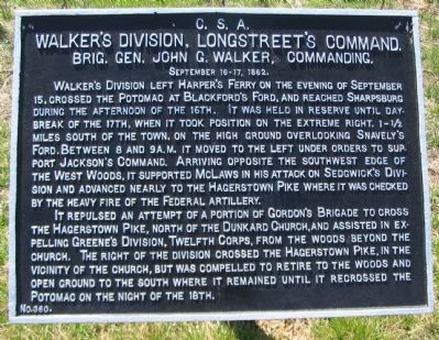
Walker's Division, Longstreet's Command.
Brig. Gen. John G. Walker, Commanding.
September 16-17, 1862.
Walker's Division left Harper's Ferry on the evening of September 15, crossed the Potomac at Blackford's Ford, and reached Sharpsburg during the afternoon of the 16th. It was held in reserve until daybreak of the 17th, when it took position on the extreme right, 1-½ miles south of the town, on the high ground overlooking Snavely's Ford. Between 8 and 9 a.m. it moved to the left under orders to support Jackson's Command. Arriving opposite the southwest edge of the West Woods, it supported McLaws in his attack on Sedgwick's Division and advanced nearly to the Hagerstown Pike where it was checked by the heavy fire of the Federal artillery.
It repulsed an attempt of a portion of Gordon's Brigade to cross the Hagerstown Pike, north of the Dunkard Church, and assisted in repelling Greene's Division, Twelfth corps, from the woods beyond the church. The right of the division crossed the Hagerstown Pike, in the vicinity of the church, but was compelled to retire to the woods and open ground to the south where it remained until it recrossed the Potomac on the night of the 18th.
Erected by Antietam Battlefield Board. (Marker Number 360.)
Topics and series. This historical marker is listed in this topic list: War, US Civil. In addition, it is included in the Antietam Campaign War Department Markers series list. A significant historical month for this entry is September 1862.
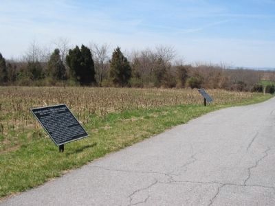
Location. 39° 28.509′ N, 77° 44.882′ W. Marker is near Sharpsburg, Maryland, in Washington County. Marker is on Smoketown Road, on the right when traveling east. Touch for map. Marker is in this post office area: Sharpsburg MD 21782, United States of America. Touch for directions.
Other nearby markers. At least 8 other markers are within walking distance of this marker. Purnell Legion Infantry (a few steps from this marker); 125th Pennsylvania Volunteer Infantry (a few steps from this marker); Longstreet's Command (a few steps from this marker); 125th Penna (a few steps from this marker); 34th New York Infantry (a few steps from this marker); Dunker Church - "Symbol of Peace and Brotherhood" (about 400 feet away, measured in a direct line); Beacon of Peace (about 400 feet away); Destroy the Rebel Army (about 400 feet away). Touch for a list and map of all markers in Sharpsburg.
Related markers. Click here for a list of markers that are related to this marker. Walker's Division at Antietam.
Also see . . .
1. Antietam Battlefield. National Park Service site. (Submitted on April 5, 2008, by Craig Swain of Leesburg, Virginia.)
2. Walker's Division, Longstreet's Command. In his official report, Walker described the fighting in this sector: "[Manning's Brigade] not content with the possession of the woods, dashed forward in gallant style, crossed the open fields beyond, driving the enemy before him like sheep, until, arriving at a long line of strong post and rail fences, behind which heavy masses of the enemy's infantry were lying, their advance was checked; and it being impossible to climb over these fences under such fire, these regiments, after suffering a heavy loss, were compelled to fall back to the woods" (Submitted on April 5, 2008, by Craig Swain of Leesburg, Virginia.)

Photographed By Craig Swain, March 29, 2008
3. Arrival of Walker's Division
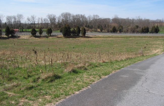
Looking west down the Smoketown Road Extension with the modern Hagerstown Pike bypass running left to right in the background. Walker's Division arrived behind McLaws Division and deployed to support the counterattacks into the West Woods. Manning's Brigade (commanded by Col. Manning at the battle, but sometimes called Walker's Brigade) was in the lead and deployed behind Kershaw's Brigade in the low ground here. Ramsom's Brigade followed and deployed further to the north and into the heart of the West Woods.
Credits. This page was last revised on December 7, 2017. It was originally submitted on April 5, 2008, by Craig Swain of Leesburg, Virginia. This page has been viewed 869 times since then and 12 times this year. Photos: 1, 2, 3. submitted on April 5, 2008, by Craig Swain of Leesburg, Virginia.

