Wissahickon Valley Park in Philadelphia in Philadelphia County, Pennsylvania — The American Northeast (Mid-Atlantic)
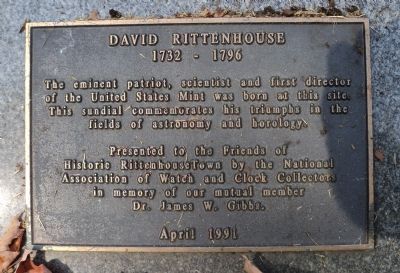
David Rittenhouse
1732 - 1796
Presented to the Friends of
Historic RittenhouseTown by the National
Association of Watch and Clock Collectors
in memory of our mutual member
Dr. James W. Gibbs.
April 1991
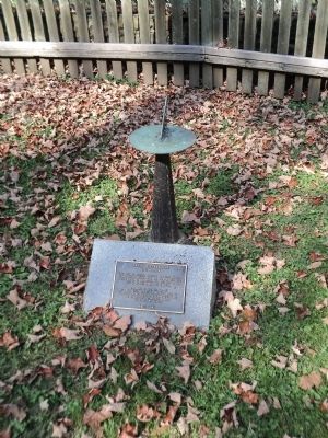
Erected 1991.
Topics. This historical marker is listed in these topic lists: Air & Space • Industry & Commerce • Science & Medicine. A significant historical month for this entry is April 1991.
Location. 40° 1.762′ N, 75° 11.385′ W. Marker is in Philadelphia, Pennsylvania, in Philadelphia County. It is in Wissahickon Valley Park. Marker can be reached from Lincoln Drive, on the right when traveling south. Marker is accessible from the parking area for Rittenhouse Town off Lincoln Drive. Touch for map. Marker is at or near this postal address: 1690 Lincoln Dr, Philadelphia PA 19144, United States of America. Touch for directions.
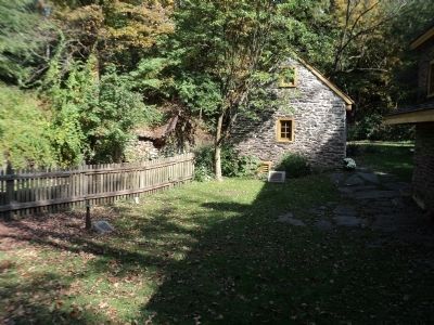
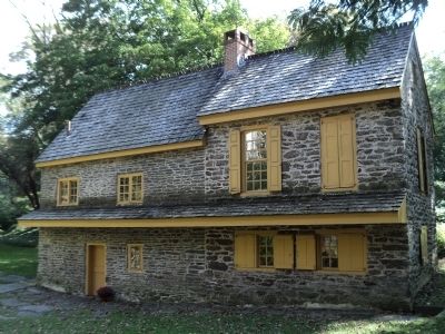
Other nearby markers. At least 8 other markers are within walking distance of this marker. Rittenhouse Homestead (here, next to this marker); Colonial Herb Garden (a few steps from this marker); Rittenhouse Town (within shouting distance of this marker); Rittenhousetown Historic District (within shouting distance of this marker); The Jacob Rittenhouse Home at RittenhouseTown (about 300 feet away, measured in a direct line); Battle of Germantown (about 400 feet away); Dr. Mary Davis Ridgway (about 800 feet away); Ten Box Shelter (approx. 0.2 miles away). Touch for a list and map of all markers in Philadelphia.
Photographed By Allen C. Browne, February 16, 2015
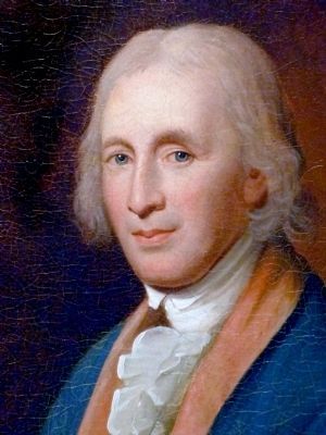
5. David Rittenhouse
This 1796 portrait of David Rittenhouse by Charles Willson Peale hangs in the National Portrait Gallery in Washington DC.
“A child prodigy who received no formal education, David Rittenhouse became one of early America's most respected scientists and is depicted here as president of the American Philosophical Society. Rittenhouse made his living as a clock-and instrument-maker; his mathematical skills earned him service on commissions determining the boundaries of several states. He constructed two orreries, instruments that accurately depict the motions of the solar system for 5,000 years, backwards and forwards. Rittenhouse achieved international fame when, acting on John Ewing's proposal, he organized the Philosophical Society's participation in an international effort to measure the transit of Venus. This allowed astronomers to more accurately measure distances to celestial objects. Rittenhouse's published observations, along with those of other American scientists, attracted favorable reactions in Europe, bringing a new recognition of American scientific achievement.” — National Portrait Gallery
“A child prodigy who received no formal education, David Rittenhouse became one of early America's most respected scientists and is depicted here as president of the American Philosophical Society. Rittenhouse made his living as a clock-and instrument-maker; his mathematical skills earned him service on commissions determining the boundaries of several states. He constructed two orreries, instruments that accurately depict the motions of the solar system for 5,000 years, backwards and forwards. Rittenhouse achieved international fame when, acting on John Ewing's proposal, he organized the Philosophical Society's participation in an international effort to measure the transit of Venus. This allowed astronomers to more accurately measure distances to celestial objects. Rittenhouse's published observations, along with those of other American scientists, attracted favorable reactions in Europe, bringing a new recognition of American scientific achievement.” — National Portrait Gallery
Credits. This page was last revised on February 2, 2024. It was originally submitted on October 6, 2013, by Bill Coughlin of Woodland Park, New Jersey. This page has been viewed 593 times since then and 21 times this year. Photos: 1, 2, 3, 4. submitted on October 6, 2013, by Bill Coughlin of Woodland Park, New Jersey. 5. submitted on May 25, 2015, by Allen C. Browne of Silver Spring, Maryland.
