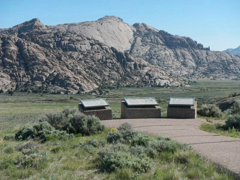
Near Jeffrey City in Fremont County, Wyoming — The American West (Mountains)
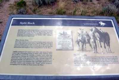
Split Rock
How it was done
Mail relay stations were set up 10 to 15 miles apart, each with two to four men and extra horses. About 500 of the hardiest western ponies were bought at prices up to $200 each. Most important of all, 80 riders were recruited from the most daring, determined and toughest "wiry young fellows" in the West.
Lightly equipped and armed, each rider rode about 70 miles round trip, exchanging horses at three relay stations. Over his saddle he carried the mochila, a leather cover with four mail pouches. Postage for a single letter varied from $1 to $5. Each rider rode at top speed to his relay stations where the precious mochila was placed on a waiting horse and he was off again in about two minutes. Day and night, good weather and bad, winter and summer, the "Pony" never stopped, averaging 10 to 15 miles an hour across the West.
The Pony's echo
Completion of the transcontinental telegraph line on October 24, 1861 doomed the Pony Express. During its short life, the Express attracted world-wide attention that has not faded with time. Russell, Majors, Waddell and Company lost over $1 million on this venture. Nevertheless, the Pony Express stands tall as an outstanding example of American enterprise, endurance, courage and determination.
Erected by Bureau of Land Management.
Topics and series. This historical marker is listed in these topic lists: Communications • Roads & Vehicles. In addition, it is included in the California Trail, the Mormon Pioneer Trail, the Oregon Trail, and the Pony Express National Historic Trail series lists. A significant historical month for this entry is October 1861.
Location. 42° 27.253′ N, 107° 32.743′ W. Marker is near Jeffrey City, Wyoming, in Fremont County. Marker can be reached from U.S. 287, one mile west of California Emigrant Road, on the right when traveling west. Marker is located at a BLM interpretive pullout on the north side of US Route 287 approx. 16 miles east of Jeffrey City and approx. 8 miles northwest of State Route 220. Touch for map. Marker is in this post office area: Jeffrey City WY 82310, United States of America. Touch for directions.
Other nearby markers. At least 7 other markers are within 9 miles of this marker, measured as the crow flies. Pony Express (here, next to this marker); Split Rock Meadows (here, next to this marker); Trails to Opportunity (within shouting distance of this marker); Wild Horses (within shouting distance of this marker); a different marker also named Split Rock (within shouting distance of this marker); a different marker also named Split Rock (approx. 3.2 miles away); Muddy Gap (approx. 8.2 miles away).
Credits. This page was last revised on July 6, 2016. It was originally submitted on October 22, 2013, by Duane Hall of Abilene, Texas. This page has been viewed 662 times since then and 18 times this year. Photos: 1, 2. submitted on October 22, 2013, by Duane Hall of Abilene, Texas. 3, 4. submitted on December 23, 2012, by Duane Hall of Abilene, Texas. 5. submitted on July 5, 2016, by Barry Swackhamer of Brentwood, California.
Editor’s want-list for this marker. Photos with wide-view of marker and surroundings. • Can you help?
