Fulton in Callaway County, Missouri — The American Midwest (Upper Plains)
Boone's Rock
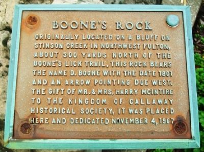
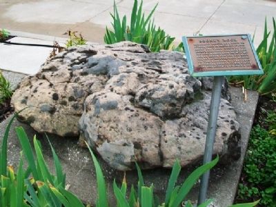
Originally located on a bluff on Stinson Creek in northwest Fulton, about 200 yards north of the Boone's Lick Trail, this rock bears the name D. Boone with the date 1801 and an arrow pointing due west.
Erected 1967 by Kingdom of Callaway Historical Society, gift of Mr. & Mrs. Harry McIntire.
Topics. This historical marker is listed in these topic lists: Roads & Vehicles • Settlements & Settlers. A significant historical date for this entry is November 4, 1967.
Location. 38° 50.834′ N, 91° 56.852′ W. Marker is in Fulton, Missouri, in Callaway County. Marker is at the intersection of 5th Street and Court Street, on the right when traveling east on 5th Street. Marker is on the north grounds of the county courthouse. Touch for map. Marker is at or near this postal address: 10 East 5th Street, Fulton MO 65251, United States of America. Touch for directions.
Other nearby markers. At least 8 other markers are within walking distance of this marker. War Memorial (here, next to this marker); Captain James Callaway (here, next to this marker); Callaway County Men at War (a few steps from this marker); Fulton - 1824 (within shouting distance of this marker); Fulton (approx. 0.2 miles away); Memorial Park (approx. 0.2 miles away); a different marker also named War Memorial (approx. 0.2 miles away); Alpha Delta of Beta Theta Pi (approx. 0.4 miles away). Touch for a list and map of all markers in Fulton.
Also see . . .
1. Boone's Lick Road Association. Website homepage (Submitted on October 24, 2013, by William Fischer, Jr. of Scranton, Pennsylvania.)
2. Boone's Lick Trail Maps. Route 40 website entry (Submitted on October 24, 2013, by William Fischer, Jr. of Scranton, Pennsylvania.)
Credits. This page was last revised on September 8, 2023. It was originally submitted on October 24, 2013, by William Fischer, Jr. of Scranton, Pennsylvania. This page has been viewed 669 times since then and 25 times this year. Photos: 1, 2. submitted on October 24, 2013, by William Fischer, Jr. of Scranton, Pennsylvania.

