Darnestown in Montgomery County, Maryland — The American Northeast (Mid-Atlantic)
Civil War Troops & Darnestown Residents
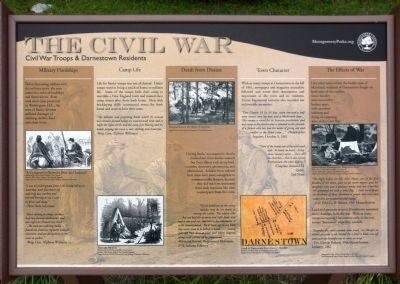
The Civil War
Military Hardships
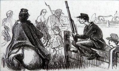
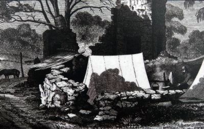
Before becoming soldiers with military spirit, the men endured a series of hardships and deprivations. Even with their close proximity to Washington D. C. the men of Banks' division suffered shortages of clothing, shelter, food and clean water.
"I was on picket guard from 1:30 Friday till noon Saturday, with four hours off and only two crackers and one red herring to eat. Came in faint and sleepy." — New York Volunteer
"Since coming to camp, we have had two furious northeasters and last night ice formed very thick, ... The men are suffering badly,...I found one Indiana regiment without overcoats, and yet doing duty on the river as pickets." — Brigadier General Alpheus Williams
Camp Life
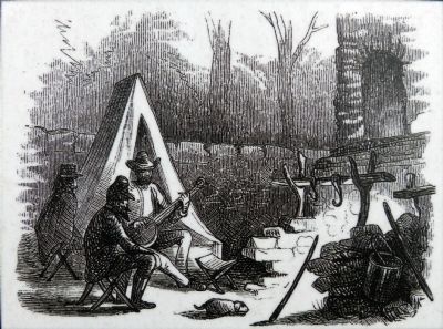
Life for Banks's troops was not all dismal. Union troops tried to bring a touch of home to military life. Some of the troops built their camp to resemble a New England town and named camp streets after those back home. Men with bricklaying skills constructed ovens for fresh bread and ways to heat their tents.
"The hillsides and projecting knobs with lie around our circular-formed valley are covered with tents and at night lights are lit and the camp fires blazing and the bands playing the scene is very striking and beautiful." — Brigadier General Alpheus Williams
Death from disease
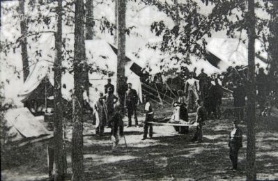
During Banks' encampment, deaths resulted not from battles wounds but from illness such as typhoid, measles, dysentery, pneumonia, and tuberculosis. Soldiers form isolated farm areas were more susceptible to communicable diseases, because they did not have immunity from early exposure like their counterparts from the cities.
"Of all liabilities in the army measles may be set down as among the worst. The soldier who has not had the genuine and right kind, and had it out and out, previous to his enlistment, is to be commiserated. He is more apt to die from that cause than to be killed in battle.... Several splendid boys died at once and others lingered along until carried off by pneumonia. " — Edmund Brown, Regimental Historian, 27th Indiana Infantry.
Town Character
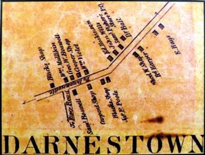
With so many troops a Darnestown in fall of 1861, newspaper and magazine journalists followed and wrote their descriptions and impression of the town and its residents. Union Regimental histories also recorded not so favorable memories.
"One Church 16 by 24 feet, seven one-and-a half story houses, two log huts and a blacksmith shop....This country is noted for it Secession proclivities; and our camp at the present time is situated on the grounds of a farmer who
has had the name of giving aid and comfort to the Rebel cause.... " — Philadelphia Inquirer, October 5, 1861
"Most of the homes are of log-and-mud style. It boasts no hotel....It has three 'country' stores....There are two Churches....One is old School Presbyterian; the other Baptist. " — Chaplain Alonzon H. Quint, 2nd Mass.
The Effects of War
Like other areas within the border state of Maryland, residents of Darnestown fought on both sides of the conflict. Some families were irreversibly broken apart, with members enlisting and dying on opposing sides of the Civil War.
"The night before we left, Mrs. Hayes, one of the first families of the town, gave us an oyster supper, and her daughter, who was a pleasant young lady but red-hot 'reb' presented me with a rebel flag. I shall never forget the kindness of thos darnestown people and trust that today they are prosperous and happy. " — Cpl. John G.B. Adams, 19th Massachusetts
Land and Property around Darnestown sustained heavy damages from the war. With so many troops occupying Darnestown early in the war, troops "borrowed" what they need.
"Yesterday the cooks wanted some wood...we thought we would get some so we started for a fence a little way off, and each on brought one more to camp." " — Pvt. George
Pollard, 38th Massachusetts Infantry, 1861
Erected 2012 by Montgomery Parks.
Topics. This historical marker is listed in this topic list: War, US Civil. A significant historical month for this entry is October 1906.
Location. 39° 6.215′ N, 77° 17.448′ W. Marker is in Darnestown, Maryland, in Montgomery County. Marker can be reached from Darnestown Road (Maryland Route 28) east of Seneca Road (Maryland Route 112), on the left when traveling east. Located in Darnestown Square Heritage Park. Touch for map. Marker is at or near this postal address: 14029 Darnestown Road, Gaithersburg MD 20878, United States of America. Touch for directions.
Other nearby markers. At least 8 other markers are within walking distance of this marker. Darnestown: A Strategic Point of Defense (here, next to this marker); The Civil War in Darnestown (here, next to this marker); The Signal Corps and Wartime Communications (here, next to this marker); Disease, Death, and Medical Discoveries During the Civil War (within shouting distance of this marker); Clues to the Past: Oral History and Archaeology (within shouting distance of this marker); A 19th Century Crossroads (within shouting distance of this marker); Andrew Small Academy (within shouting distance of this marker); The Origins of Darnestown (within shouting distance of this marker). Touch for a list and map of all markers in Darnestown.
Credits. This page was last revised on December 4, 2018. It was originally submitted on October 30, 2013, by Allen C. Browne of Silver Spring, Maryland. This page has been viewed 645 times since then and 18 times this year. Photos: 1, 2, 3, 4, 5, 6. submitted on October 30, 2013, by Allen C. Browne of Silver Spring, Maryland. • Bernard Fisher was the editor who published this page.
