Wagram in Scotland County, North Carolina — The American South (South Atlantic)
Wagram
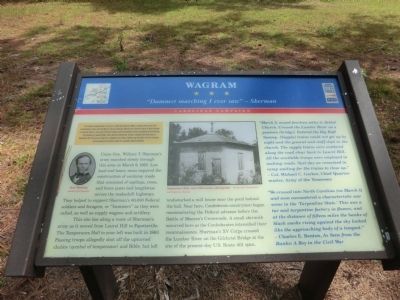
"Damnest marching I ever saw" — Sherman
— Carolinas Campaign —
The Carolinas Campaign began on February 1, 1865, when Union Gen. William T. Sherman led his army north from Savannah, Georgia, after the March to the Sea. Sherman’s objective was to join Gen. Ulysses S. Grant in Virginia to crush Gen. Robert E. Lee’s Army of Northern Virginia. Scattered Confederate forces consolidated in North Carolina, the Confederacy’s logistical lifeline, where Sherman defeated Gen. Joseph E. Johnston’s last-ditch attack at Bentonville. After Sherman was reinforced at Goldsboro late in March, Johnston saw the futility of further resistance and surrendered near Durham on April 26, essentially ending the Civil War.
(main text)
Union Gen. William T. Sherman’s army marched slowly through this area on March 9, 1865. Low land and heavy rains required the construction of corduroy roads that consisted of saplings, trees, and fence posts laid lengthwise across the makeshift highways. They helped to support Sherman’s 60,000 Federal soldiers and foragers, or “bummers” as they were called, as well as supply wagons and artillery.
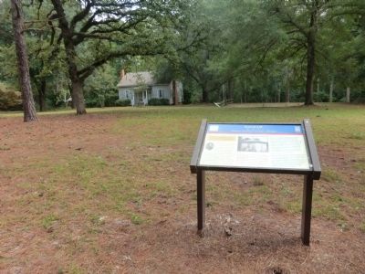
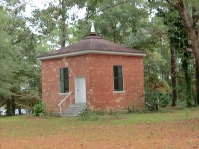
This site lies along the route of Sherman’s army as it moved from Laurel Hill to Fayetteville. The Temperance Hall to your left was built in 1860. Passing troops allegedly shot off the upturned chalice (symbol of temperance) and Bible, but left undisturbed a mill house near the pond behind the hall. Near here, Confederate cavalrymen began reconnoitering the Federal advance before the Battle of Monroe’s Crossroads. A small skirmish occurred here as the Confederates intensified their reconnaissance. Sherman’s XV Corps crossed the Lumber River on the Gilchrist Bridge at the site of the present-day U.S. Route 401 span.
“March 9, moved fourteen miles to Bethel Church. Crossed the Lumber River on a pontoon (bridge). Entered the Big Raft Swamp, (Supply) trains could not get up by night and the general and staff slept in the church. The supply trains were scattered along the road clear back to Laurel Hill. All the available troops were employed in making roads. Next day we remained in camp waiting for the trains to close up.” – Col. Michael C. Garber, Chief Quartermaster, Army of the Tennessee.
“We crossed into North Carolina (on March 8) and soon encountered a characteristic war scene in the ‘Turpentine State.’ This was a tar and turpentine factory in flames, and at the distance of fifteen miles the banks of black smoke rising against the sky looked like the approaching body of a tempest.” – Charles E. Benton, As Seen from the Ranks: A Boy in the Civil War.
(captions)
(left) Gen. Sherman Library of Congress
(right) Temperance Hall, early-20th-century photograph. — Richmond Temperance and Literary Society
Erected by North Carolina Civil War Trails.
Topics and series. This historical marker is listed in this topic list: War, US Civil. In addition, it is included in the North Carolina Civil War Trails series list. A significant historical month for this entry is February 1849.
Location. 34° 53.034′ N, 79° 23.316′ W. Marker is in Wagram, North Carolina, in Scotland County. Marker can be reached from Spring Hill Road north of Old Wire Road (North Carolina Highway 144), on the right when traveling north. Touch for map. Marker is in this post office area: Wagram NC 28396, United States of America. Touch for directions.
Other nearby markers. At least 8 other markers are within 8 miles of this marker, measured as the crow flies. Spring Hill Baptist Church (a few steps from this marker); Gerald Johnson (approx. 1.1 miles away); John Charles McNeill (approx. 1.1 miles away); Temperance Hall (approx. 1.1 miles away); Sherman's March (approx. 5 miles away); Old Laurel Hill Church (approx. 5.7 miles away); World War II Glider Pilots (approx. 6.1 miles away); Laurinburg Institute (approx. 8 miles away). Touch for a list and map of all markers in Wagram.
Credits. This page was last revised on June 16, 2016. It was originally submitted on November 22, 2013, by Don Morfe of Baltimore, Maryland. This page has been viewed 987 times since then and 55 times this year. Photos: 1, 2, 3. submitted on November 22, 2013, by Don Morfe of Baltimore, Maryland. • Bernard Fisher was the editor who published this page.


