Greenville in Butler County, Alabama — The American South (East South Central)
Butler County
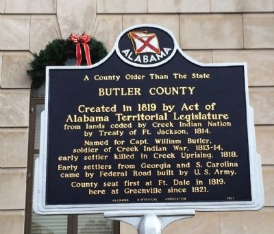
A County Older Than The State
Created in 1819 by Act of Alabama Territorial Legislature from lands ceded by the Creek Indian Nation by the Treaty of Fort Jackson, 1814.
Named for Captain William Butler, soldier of Creek Indian War, 1813-14, early settler killed in Creek Uprising, 1818.
Early settlers from Georgia and South Carolina came by Federal Road built by U.S. Army.
County seat first at Fort Dale in 1819, here at Greenville since 1821.
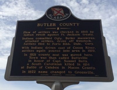
Side 2
Flow of settlers was checked in 1818 by Indian revolt against Fort Jackson treaty.
Indians committed Ogly, Butler massacres; attacked settlers, drove off livestock. Settlers fled to Forts Bibb, Dale, Gary.
With the Indians driven east of Coosa River, settlers poured into area in 1819.
In 1821 county seat was moved here. The town was then called Buttsville in honor of Capt. Samuel Butts, a South Carolinian killed in 1814 at Battle of Calabee in Macon County.
In 1822 the name changed to Greenville.
Erected 1957 by Alabama Historical Association.
Topics and series. This historical marker is listed in these topic lists: Native Americans • Settlements & Settlers. In addition, it is included in the Alabama Historical Association series list. A significant historical year for this entry is 1819.
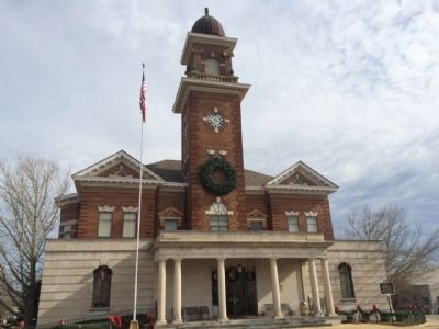
Location. 31° 49.771′ N, 86° 37.093′ W. Marker is in Greenville, Alabama, in Butler County. Marker is at the intersection of East Commerce Street (Alabama Route 10) and South Conecuh Street (County Route 45), on the left when traveling east on East Commerce Street. Touch for map. Marker is at or near this postal address: 700 Court Square, Greenville AL 36037, United States of America. Touch for directions.
Other nearby markers. At least 8 other markers are within walking distance of this marker. Butler County World War I Memorial (a few steps from this marker); Butler County Vietnam War Memorial (within shouting distance of this marker); Operation Desert Storm (within shouting distance of this marker); Site of Confederate Hospital (approx. ¼ mile away); In Memory of Captain William Butler (approx. ¼ mile away); Pioneer Cemetery (approx. ¼ mile away); World War II Memorial (approx. ¼ mile away); Greenville City Hall-Site of Public School / Confederate Park (approx. 0.3 miles away). Touch for a list and map of all markers in Greenville.
Credits. This page was last revised on June 16, 2016. It was originally submitted on December 14, 2013, by Mark Hilton of Montgomery, Alabama. This page has been viewed 1,171 times since then and 46 times this year. Photos: 1, 2, 3. submitted on December 14, 2013, by Mark Hilton of Montgomery, Alabama. • Bernard Fisher was the editor who published this page.


