Near Hagerman in Gooding County, Idaho — The American West (Mountains)
History of the Malad River
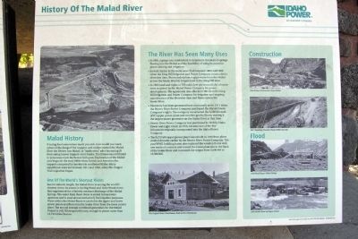
Malad History
If eating food somewhere made you sick, how would you warn others of the danger? Fur trappers and traders named the Malad River the Riviere Aux Malad, or “sickly river,” after becoming hill from eating beaver trapped on its banks. The illness was attributed to poisonous roots the beaver fed upon. Exploration of the Malad area began in the early 1800s when British and American fur trappers competed for territory in southwest Idaho. Many expeditions were led between 1811 and 1843, when the Oregon Trail migration began.
One of the World’s Shortest Rivers
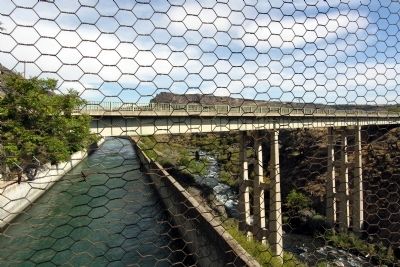
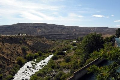
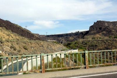
Just 2.5 miles in length, the Malad River is among the world’s shortest rivers. Its source is the Big Wood and Little Wood rivers that supplement the relatively constant discharge of the Malad Springs. The water from these rivers is stored in reservoirs upstream and is used almost exclusively for irrigation purposes. Water within the Malad flume is carried to the upper and lower power plants and flows into the Snake River from the lower power plant. The annual average combined generation for the Malad Project is 168,733 megawatt hours, enough to power more than 13,750 Idaho homes.
The River Has Seen Many Uses
- In 1899, a gauge was established to determine the yield of springs flowing into the Malad and the feasibility of using its water for placer mining and irrigation.
- Several claims to the water were filed between 1902 and 1908 when the Kin Hill Irrigation and Power Company constructed a diversion dam, flume and siphon to pipe water from the Malad across the Snake River to irrigate land in the King Hill area.
- In 1909 land and rights to 700 cubic feet per second (cfs) of water were acquired by the Malad Power Company for power development. The agreement also allocated 300 cfs to the King Hill Irrigation and Power Company for irrigation and ongoing maintenance of the diversion dam and flume across the Snake River.
- Electricity has been generated here continually since 1911 when the Beaver River Power Company purchased the Malad Power Company’s rights. The company constructed the 5,000 kilowatt (kW) upper power plant and wooden gravity flume, making it the largest power generator on the Snake River at that time.
- Beaver River Power Company was purchased in 1913 by Idaho Power and Light which in 1916, became one of the five companies originally incorporated into the Idaho Power Company.
- The 8,270 kW upper power plant was rebuilt in 1948 from plans drafted decades earlier by the Beaver River Power Company. The post WWII building boom also replaced the wooden flume with one made of concrete and moved the lower plant site to the bank of the Snake River and increased the output from 5,000 kW to 13,500 kW.
Erected 2008 by Idaho Power.
Topics. This historical marker is listed in these topic lists: Agriculture • Exploration • Industry & Commerce. A significant historical year for this entry is 1811.
Location. 42° 51.918′ N, 114° 53.808′ W. Marker is near Hagerman, Idaho, in Gooding County. Marker can be reached from the intersection of River Road and U.S. 30. Touch for map. Marker is in this post office area: Hagerman ID 83332, United States of America. Touch for directions.
Other nearby markers. At least 8 other markers are within 8 miles of this marker, measured as the crow flies. Woody's Cove / The Hagerman Valley (approx. 1.1 miles away); Fossil Beds (approx. 1.7 miles away); The Malad Springs (approx. 2 miles away); Formation of Malad Gorge (approx. 2 miles away); Hagerman Sheep Monument (approx. 3 miles away); Bliss Homestead (approx. 4.1 miles away); Where are the Fossils? (approx. 7.2 miles away); "The People" (approx. 7.2 miles away). Touch for a list and map of all markers in Hagerman.
Credits. This page was last revised on June 16, 2016. It was originally submitted on February 5, 2014, by Duane Hall of Abilene, Texas. This page has been viewed 991 times since then and 101 times this year. Photos: 1, 2, 3, 4. submitted on February 5, 2014, by Duane Hall of Abilene, Texas.
Editor’s want-list for this marker. Photo of wide-view of marker and surroundings. • Can you help?


