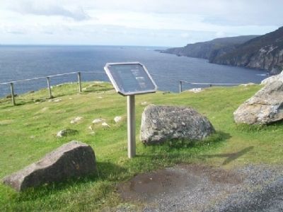
Slieve League in County Donegal, Ulster, Ireland — North West ((Éire) North Atlantic Ocean)
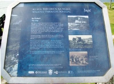
The Bog / An Portach
Walking Through Donegal
— Ag Siúl Tríd Dhún na nGall —
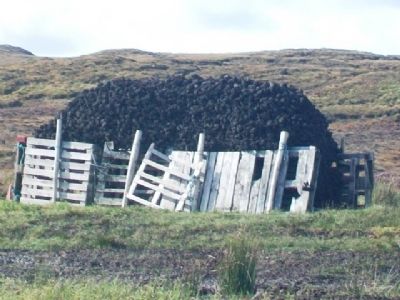
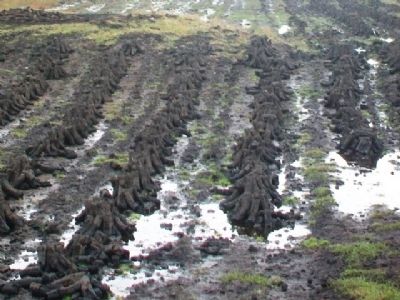
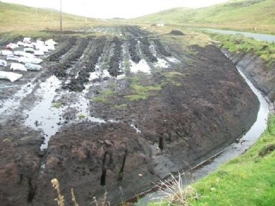
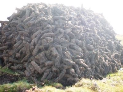
The principal fuel for heating homes in this area has always been turf, which is cut out of the bog. Cutting the turf begins around April or May when wet sods are spread on the surface to begin drying. These are then 'footed' into small piles to dry thoroughly. Once dried the turf can then be transported home in time for the winter.
The remains of old turf workings are very evident in this area and can be recognized as banks and steps across the landscape.
Ba í móin an príomh ábhar tine leis na tithe a théadh ins an cheantar seo. Baintear an mhóin as an phortach. Is i mí Aibreán nó mí na Bealtaine a chuirtear tús le sábháil na móna. Spréitear na fóideanna fliucha ar an uachtar agus ligtear dóibh triomú. Déantar iad a ghróige ansin (trí nó ceathair fód ina seasamh as a sál ag tabhairt taca dá chéile) fágtar iad mar seo go bhfuil siad tirim i gceart. Nuair atá an mhóin tirim bheirtear abhaile í i n-am don gheimhreadh.
Tá iarsmaí portaigh le feiceáil go fairsing agus tá siad aitheanta mar bruachanna agus steipeanna atá go leathanach ins an taobh seo tire.
[Photo captions read]
[1.] Smoke from turf fires has always been part of the 'landscape' of Co Donegal.
Bhi toit mónadh mar chuid de thaobh tire Cho Dhún na nGall a riamh anall.
[2.] Turf being taken home by Donkey
Móin a thabhairt abhaile le h-asal.
[3.] Working turf was often a family affair!
Is minic gur obair clainne í baint na mónadh!
Images courtesy of Coiste Forbartha Dhobhair Teo
Is le cúirtéis do Coiste Forbartha Dhobhair Teo na h-íomhánna
Erected by NDP, Fáilte Ireland, Donegal County Council, Donegal County Development Board, and Údarás na Gaeltachta.
Topics. This historical marker is listed in these topic lists: Environment • Settlements & Settlers.
Location. 54° 37.629′ N, 8° 41.094′ W. Marker is in Slieve League, Ulster, in County Donegal. Marker is at the Slieve League / Sliabh Liag overlook, at the end of the road west off Teelin Road, going south from Carrick. Follow signs. Touch for map. Touch for directions.
Other nearby markers. At least 5 other markers are within 5 kilometers of this marker, measured as the crow flies. Fishing /Iascaireacht (a few steps from this marker); Signal Towers / Túir Comharthaíochta (within shouting distance of this marker); Chough / Cág Cos-dearg (within shouting distance of this marker); Farming on Sliabh Liag / Feirmeoireacht ar Shliabh Liag (within shouting distance of this marker); Carrick / An Charraig (approx. 4.8 kilometers away).
Also see . . .
1. Irish Peatland Conservation Council. (Submitted on February 10, 2014, by William Fischer, Jr. of Scranton, Pennsylvania.)
2. Peat Bog History at YouTube. (Submitted on February 10, 2014, by William Fischer, Jr. of Scranton, Pennsylvania.)
Credits. This page was last revised on October 23, 2018. It was originally submitted on February 10, 2014, by William Fischer, Jr. of Scranton, Pennsylvania. This page has been viewed 495 times since then and 6 times this year. Photos: 1, 2, 3, 4, 5, 6. submitted on February 10, 2014, by William Fischer, Jr. of Scranton, Pennsylvania.
