Near Pine Grove in Amador County, California — The American West (Pacific Coastal)
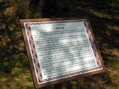
Hun'ge
Roundhouse
The sacred hun’ge was the community center for dances, meetings, social gatherings, and religious ceremonies; it is analogous to churches and other houses of worship.
The construction and care of the roundhouse was guided by ritual and great moral obligation that only a headman or “captain” could bear; therefore, roundhouses were either destroyed or abandoned after the death of their owners.
The four large center poles and beams support the roof, and thus are important structurally, but they are also important spiritually.
Near the rear wall and between the two rear poles is the foot drum tu’mma. Traditionally, a half section of hollow oak log was placed over a pit and stamped upon by the drummer to set the rhythm for the dancers.
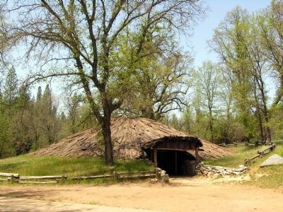
In the old days the hun’ge was 40 or 50 feet in diameter with an earth covered roof.
The hun’ge here at Chaw’se has the essential features common to traditional roundhouses, and is actively used throughout the year by the Native American community.
Please show respect for this spiritual place and do not climb on the roof.
Topics. This historical marker is listed in this topic list: Native Americans.
Location. 38° 25.434′ N, 120° 38.614′ W. Marker is near Pine Grove, California, in Amador County. Marker can be reached from Pine Grove Volcano Road, 0.3 miles north of Bryson Lane. Marker is located in Indian Grinding Rock State Historic Park; the above directions are to the intersection of Pine Grove Volcano Road and the park entrance. Touch for map. Marker is in this post office area: Pine Grove CA 95665, United States of America. Touch for directions.
Other nearby markers. At least 8 other markers are within 2 miles of this marker, measured as the crow flies. Chaw'se (about 300 feet away, measured in a direct line); Petroglyphs (Rock Carvings) (about 300 feet away); Chaw Sé Roundhouse (about 700 feet away); Pine Grove (approx. 1.1 miles away); Volcano Masonic Cave (approx. 1.4 miles away); Moose Milk (approx. 1.4 miles away); St. George Hotel (approx. 1.4 miles away); General Store (approx. 1.4 miles away). Touch for a list and map of all markers in Pine Grove.
More about this marker. Marker may reached by a 1/4 mile trail from the parking area to the marker.
Also see . . . Indian Grinding Rock State Historic Park. Official California State Parks website. (Submitted on February 21, 2014.)
Credits. This page was last revised on June 16, 2016. It was originally submitted on February 21, 2014, by Duane Hall of Abilene, Texas. This page has been viewed 523 times since then and 23 times this year. Photos: 1, 2. submitted on February 21, 2014, by Duane Hall of Abilene, Texas.
Editor’s want-list for this marker. Photo of wide-view of marker and surroundings. • Can you help?

