Near Sharpsburg in Washington County, Maryland — The American Northeast (Mid-Atlantic)
Longstreet's Command
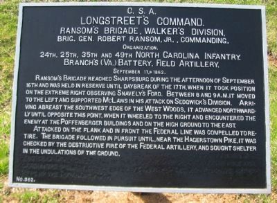
Ransom's Brigade, Walker's Division
Longstreet's Command.
Ransom's Brigade, Walker's Division.
Brig. Gen. Robert Ransom, Jr., Commanding.
Organization.
24th, 25th, 35th and 49th North Carolina Infantry.
Branch's (Va.) Battery, Field Artillery.
September 17, 1862.
Ransom's Brigade reached Sharpsburg during the afternoon of September 16th and was held in reserve until daybreak of the 17th, when it took position on the extreme right observing Snavely's Ford. Between 8 and 9 a.m. it moved to the left and supported McLaws in his attack on Sedgwick's Division. Arriving abreast the southwest edge of the West Woods, it advanced northwardly until opposite this point, when it wheeled to the right and encountered the enemy at the Poffenberger buildings and on the high ground to the east.
Attacked on the flank and in front the Federal line was compelled to retire. The brigade followed in pursuit until, near the Hagerstown Pike, it was checked by the destructive fire of the Federal artillery, and sought shelter in the undulations of the ground.
Erected by Antietam Battlefield Board. (Marker Number 362.)
Topics and series. This historical marker is listed in this topic list: War, US Civil. In addition, it is included in the Antietam Campaign War Department Markers series list. A significant historical month for this entry is September 1797.
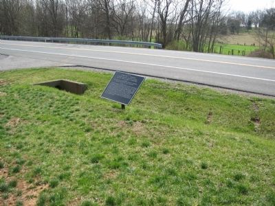
Location. 39° 28.635′ N, 77° 45.096′ W. Marker is near Sharpsburg, Maryland, in Washington County. Marker is on Hagerstown Pike (State Highway 65), on the right when traveling north. Located at stop 4 of the West Woods walking trail. Touch for map. Marker is in this post office area: Sharpsburg MD 21782, United States of America. Touch for directions.
Other nearby markers. At least 8 other markers are within walking distance of this marker. Jackson's Command (a few steps from this marker); John Lemuel Stetson (within shouting distance of this marker); Second Army Corps (about 300 feet away, measured in a direct line); a different marker also named Second Army Corps (about 300 feet away); a different marker also named Second Army Corps (about 400 feet away); Ewell's Division, Jackson's Command (about 400 feet away); a different marker also named Longstreet's Command (about 400 feet away); 15th Massachusetts Volunteer Infantry (about 400 feet away). Touch for a list and map of all markers in Sharpsburg.
Also see . . .
1. Antietam Battlefield. National Park Service site. (Submitted on April 18, 2008, by Craig Swain of Leesburg, Virginia.)
2. Ransom's Brigade, Walker's Division. General Ransom's older brother,
Col. Matt Whitaker Ramsom, commanded the 35th North Carolina Regiment. (Submitted on April 18, 2008, by Craig Swain of Leesburg, Virginia.)

Photographed By Craig Swain, April 6, 2008
3. Ransom's Brigade Clears the Federals from the Poffenberger Farm
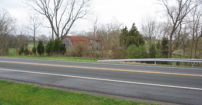
Looking across the bypass from the tablet location. Advance Federal regiments had just cleared the West Woods and were entering the Poffenberger's when the Confederate counterattack from McLaws Division struck. Ransom's Brigade from Walker's Division supported this attack and drove through the Poffenberger's.
Credits. This page was last revised on November 24, 2017. It was originally submitted on April 18, 2008, by Craig Swain of Leesburg, Virginia. This page has been viewed 863 times since then and 16 times this year. Photos: 1, 2, 3. submitted on April 18, 2008, by Craig Swain of Leesburg, Virginia.

