Near Skidmore in Anne Arundel County, Maryland — The American Northeast (Mid-Atlantic)
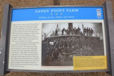
Sandy Point Farm
William Evans, Soldier and Sailor
Evans was among many Maryland blacks, slave and free, who fought in the Civil War (8,718 in the USCTs). As a border state, Maryland continued to sanction slavery during the war until a new state constitution abolished it on November 1, 1864. Before then, free blacks could enlist in the U.S. Army, and thousands of slaves fled to seek refuge with the Union troops. By early 1864, however, slaveholders such as Mezick were promised reimbursement for any slaves who enlisted. During the war, Mezick remained at Sandy Point Farm and owned the farm until the late nineteenth century.
(sidebar)
African Americans Faced Brutality
Thomas B. Davis, keeper of Sandy Point Lighthouse, wrote to a Baltimore judge on November 6th, 1984, that on the day Maryland abolished slavery, he saw men on horseback armed with whips and revolvers assaulting African Americans. "They took in the [St. Margaret Postmaster's cellar] a negro Woman stript her and with a Cow Hyde Lasarated her flesh until the Blood oozed from every cut and She within a Month of giving Birth." He documented other incidents involving men, women, and children.
Erected by Maryland Civil War Trails.
Topics and series. This historical marker is listed in these topic lists: African Americans • War, US Civil. In addition, it is included in the Maryland Civil War Trails series list. A significant historical month for this entry is March 1864.
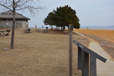
Location. This marker has been replaced by another marker nearby. It was located near 39° 0.675′ N, 76° 23.852′ W. Marker was near Skidmore, Maryland, in Anne Arundel County. Marker could be reached from South Beach Road, 0.8 miles south of Oceanic Drive when traveling south. The marker is in Sandy Point State Park, near the beach at the south end of the road, near the main bath house/summer store. Touch for map. Marker was at or near this postal address: 1100 East College Parkway, Annapolis MD 21409, United States of America. Touch for directions.
Other nearby markers. At least 8 other markers are within 5 miles of this location, measured as the crow flies. The Fight for Freedom (within shouting distance of this marker); Sandy Point Shoal Lighthouse (about 800 feet away, measured in a direct line); Tense Time
(approx. ¼ mile away); Sandy Point Farmhouse - Circa 1815 (approx. ¼ mile away); Annapolis Laboratory (approx. 4.2 miles away); Fort Nonsense (approx. 4.2 miles away); British Takeover (approx. 4.4 miles away); Broad Creek Cemetery (approx. 4½ miles away). Touch for a list and map of all markers in Skidmore.
Credits. This page was last revised on September 9, 2023. It was originally submitted on March 3, 2014, by A. Taylor of Laurel, Maryland. This page has been viewed 959 times since then and 54 times this year. Photos: 1, 2, 3. submitted on March 3, 2014, by A. Taylor of Laurel, Maryland. • Bernard Fisher was the editor who published this page.


