Columbia in Tuolumne County, California — The American West (Pacific Coastal)
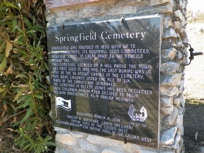
Springfield Cemetery
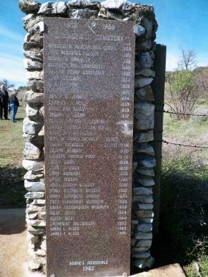
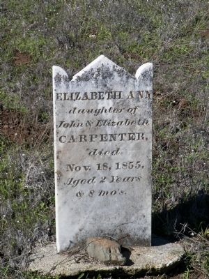
This cemetery, located on a hill above the town, was first used in 1852 and the last burial was in 1997. Of the 34 known graves in the cemetery, nine were children under the age of six.
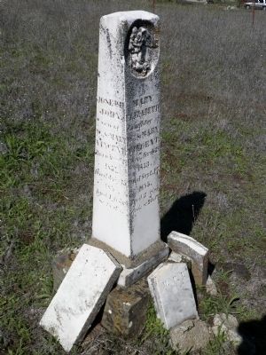
Many of the graves are unmarked.
The cemetery in recent years has been neglected until Columbia Parlor #258 decided to begin regular maintenance as a parlor activity.
Erected 2014 by Grand Parlor and Columbia Parlor #258 Native Sons of the Golden West. (Marker Number 137-08.)
Topics and series. This historical marker is listed in this topic list: Cemeteries & Burial Sites. In addition, it is included in the Native Sons/Daughters of the Golden West series list. A significant historical year for this entry is 1850.
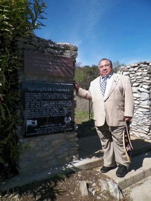
Location. 38° 1.348′ N, 120° 24.926′ W. Marker is in Columbia, California, in Tuolumne County. Marker is on Horseshoe Bend Road, 0.2 miles west of Springfield Road, on the left when traveling west. Turn into the dirt driveway/parking area. The gate to the cemetery is about 100 feet from the road and the marker is on the left gate pillar. Touch for map. Marker is in this post office area: Columbia CA 95310, United States of America. Touch for directions.
Other nearby markers. At least 8 other markers are within 2 miles of this marker, measured as the crow flies. Springfield (approx. 0.2 miles away); Columbia (approx. 0.9 miles away); Hon. Jesse M. Mayo (approx. 1.1 miles away); Eagle Cotage (approx. 1.1 miles away); Hildreth Party (approx. 1.1 miles away); Columbia Masonic Temple (approx. 1.1 miles away); Site of Donnell & Parsons Building (approx. 1.1 miles away); Scraping the Rocks Clean (approx. 1.1 miles away). Touch for a list and map of all markers in Columbia.
Also see . . .
1. Springfield Cemetery Records. "This Camp, situated at the head of Morman creek, receives its name from the fine spring that breaks out from that point,affording sufficient water to give employment to several hundred men..." - Miners & Business Men's Directory. 1856 (Submitted on March 10, 2014, by James King of San Miguel, California.)
2. Find A Grave - Springfield Cemetery. (Submitted on March 10, 2014, by James King of San Miguel, California.)
3. Sierra Nevada Geotourism - Springfield. "...The city was also one of only four communities in Tuolumne County to be incorporated during the Gold Rush era....Springfield offered its 2,000 residents an emerging infrastructure similar to other Gold Rush era towns. In 12 blocks, the town offered 200 lots and included a store, a saloon, a hotel, two churches, a school and a post office. Springfield
set itself apart because residents also led a Temperance Society, debating society and a Cotillion Club. These societies added a unique cultural element for the young men and women, while protesting the consumption of alcohol. Alcohol and the many saloons where it was served was a mainstay of most Gold Rush towns throughout the Mother Lode..." (Submitted on March 10, 2014, by James King of San Miguel, California.)
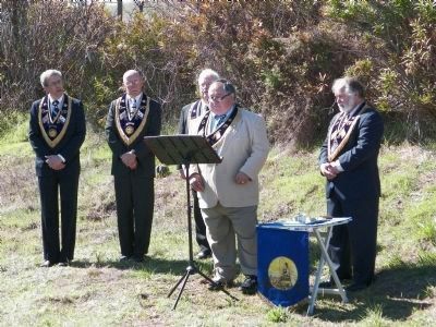
Photographed By James King, March 8, 2014
3. NSGW Springfield Cemetery Dedication
(l-r)Grand 3rd Vice President Paul Lapachet,
South San Francisco Parlor #157
Grand 2nd Vice President Doug Calkins,
Arrowhead Parlor #110
Grand 1st Vice President Tim Tullius,
Golden Gate Parlor #29
Grand President Dwight Dutschke,
Ione Parlor #33
Past Grand President Allan Baird,
Fairfield Parlor #93
South San Francisco Parlor #157
Grand 2nd Vice President Doug Calkins,
Arrowhead Parlor #110
Grand 1st Vice President Tim Tullius,
Golden Gate Parlor #29
Grand President Dwight Dutschke,
Ione Parlor #33
Past Grand President Allan Baird,
Fairfield Parlor #93
Credits. This page was last revised on June 16, 2016. It was originally submitted on March 10, 2014, by James King of San Miguel, California. This page has been viewed 457 times since then and 29 times this year. Photos: 1, 2, 3, 4, 5, 6, 7. submitted on March 10, 2014, by James King of San Miguel, California. • Syd Whittle was the editor who published this page.
