Parkers Crossroads in Henderson County, Tennessee — The American South (East South Central)
The Tides of War
Union Victory in the West — January-June 1862
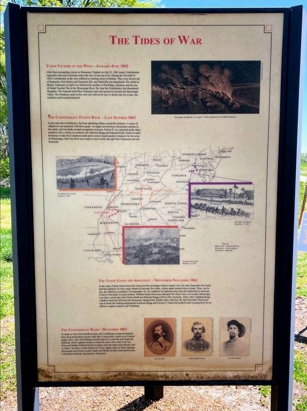
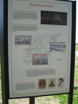
After their resounding victory at Manassas, Virginia on July 21, 1861, many Confederates expected a fast and victorious end to the war. It was not to be. During the first half of 1862 Confederates in the west suffered a crushing series of defeats. They were forced out of Kentucky, Forts Henry and Donelson fell, and Nashville was abandoned. The defeat at Shiloh, Tennessee in April was followed by another at Pea Ridge, Arkansas and the loss of Island Number Ten in the Mississippi River. By June the Confederacy had abandoned Memphis. The Southern cause in the west was well on its way to defeat and, for a time, the rebellion itself seemed doomed.
inset: The capture of Island No. 10 on April 7, 1862 as depicted by artist William Torgerson
The Confederacy Fights Back — Late Summer 1862
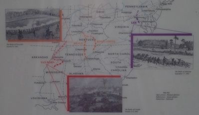
In late June the Confederacy, far from admitting defeat, seized the initiative. A series of offensives was launched with three goals – to regain lost territory, demoralize citizens in the north, and win badly needed recognition overseas. Robert E. Lee marched north, determined to win a victory on northern soil. Braxton Bragg and Kirby Smith invaded Kentucky to take the Commonwealth and to recruit much needed volunteers for the army. In Mississippi, Earl Van Dorn was ready to move north, through West Tennessee and into Kentucky.
The Union Gains the Advantage — September-November 1862
In the wake of these bold actions the Union lost the advantage it had so dearly won. By early September the South held the initiative in every major theater of war and, for a time, victory again seemed close at hand. Then, one by one, the offensives crumbled. On September 18, Lee withdrew his battered army from the battlefield at Antietam Creek in Maryland. In early October, William Starke Rosecrans defeated Van Dorn's force at Corinth, Mississippi. Less than a week later, Don Carlos Buell met Braxton Bragg at Perryville, Kentucky. After a day's fighting Bragg withdrew from the field and into Tennessee, taking Kirby Smith's army with him. By late November, Rosecrans was at Nashville making preparations to pursue Bragg and Ulysses S. Grant had pushed south in preparation for an offensive against Jackson and Vicksburg.
The Confederate Raids — December 1862
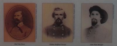
To delay or stop Grant and Rosecrans, the Confederate command planned three deep penetration cavalry raids that, if successful, would sever Federal supply lines. John Hunt Morgan would strike the Louisville and Nashville Railroad, which supplied troops in Nashville and to the south. Earl Van Dorn and Nathan Bedford Forrest's targets were the depot and railroad vital to Grant. Van Dorn would destroy the Union supply depot in Holly Springs, Mississippi and Forrest would cripple the Mobile & Ohio Railroad between Columbus, Kentucky and Jackson, Tennessee.
inset: portraits of Earl Van Dorn, Nathan Bedford Forrest and John Hunt Morgan.
Topics. This historical marker is listed in this topic list: War, US Civil. A significant historical month for this entry is July 2011.
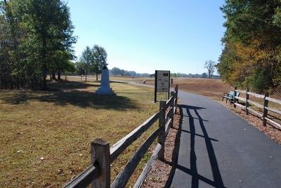
Location. 35° 47.784′ N, 88° 23.422′ W. Marker is in Parkers Crossroads, Tennessee, in Henderson County. Marker can be reached from Tennessee Route 22, 0.6 miles north of Interstate 40, on the right when traveling north. Marker is one panel of a 3-sided kiosk beside the North Loop Walking Trail. It is located 340 feet from the start of the trail just before where the trail splits. The marker is at Tour Stop 1 (Parkers Crossroads City Park) of the Driving Tour. Touch for map. Marker is in this post office area: Wildersville TN 38388, United States of America. Touch for directions.
Other nearby markers. At least 8 other markers are within walking distance of this marker. Morton's Battery (a few steps from this marker); The Battle of Parker's Crossroads (a few steps from this marker); Forrest's West Tennessee Raid (a few steps from this marker); Forrest's Tactics (within shouting distance of this marker); a different marker also named The Battle of Parker's Crossroads (about 300 feet away, measured in a direct line); Freeman's Battery (about 300 feet away); a different marker also named The Battle of Parker's Crossroads (about 300 feet away); Parker's Crossroads (about 300 feet away). Touch for a list and map of all markers in Parkers Crossroads.
Regarding The Tides of War. The marker includes a map showing 1862 Confederate offensives with the following images: The Battle of Antietam, September 17, 1862; The Battle of Corinth, October 3-4, 1862; The Battle of Perryville, October 8, 1862
Credits. This page was last revised on June 2, 2021. It was originally submitted on March 10, 2014, by David Graff of Halifax, Nova Scotia. This page has been viewed 552 times since then and 32 times this year. Photos: 1. submitted on May 30, 2021, by Shane Oliver of Richmond, Virginia. 2, 3, 4. submitted on August 21, 2015, by Brandon Fletcher of Chattanooga, Tennessee. 5. submitted on March 10, 2014, by David Graff of Halifax, Nova Scotia. 6. submitted on May 30, 2021, by Shane Oliver of Richmond, Virginia. • Bernard Fisher was the editor who published this page.
