Near Porter in Wagoner County, Oklahoma — The American South (West South Central)
Oklahoma's First Baptist Church
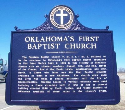
The Fountain Baptist Church ¼ mi. S. & 1 mi. E. believed to be the successor to Oklahoma's first Baptist church organized by Rev. Isaac McCoy Sept. 9, 1832 in this vicinity at Ebenezer Station with six charter members: Quasch, Bob, and Ned, slaves of the Creeks; Rev. & Mrs. David Lewis, missionaries; and John Davis, a Creek who later was the first Baptist minister ordained in what is now Oklahoma. The church grew until the Civil War when it ceased activities until the Era of Reconstruction. Meeting houses in various locations were used including a frame structure built in 1901 at site of present building erected 1956 by Black, Indian, and White Baptists of Oklahoma symbolic of these races in the church's origin.
Erected by Baptist General Convention of Oklahoma.
Topics. This historical marker is listed in these topic lists: African Americans • Churches & Religion • Native Americans • Settlements & Settlers. A significant historical date for this entry is September 9, 1848.
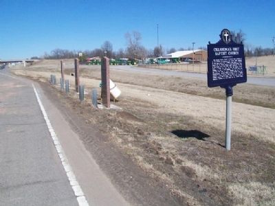
Location. 35° 49.932′ N, 95° 24.152′ W. Marker is near Porter, Oklahoma, in Wagoner County. Marker is on U.S. 69, 0.4 miles north of 820th Road, on the right when traveling north. Marker is at a roadside pullout. Touch for map. Marker is at or near this postal address: 6290 US Highway 69, Porter OK 74454, United States of America. Touch for directions.
Other nearby markers. At least 8 other markers are within 5 miles of this marker, measured as the crow flies. Wigwam Neosho (here, next to this marker); Chief Pushmataha (a few steps from this marker); Tullahassee Mission (a few steps from this marker); 42nd Infantry (Rainbow) Division National Memorial (approx. 4.4 miles away); "The Sentry" (approx. 4½ miles away); Union Agency (approx. 4.6 miles away); a different marker also named Union Agency (approx. 4.6 miles away); Muskogee Nation Commemorative Stone (approx. 4.6 miles away). Touch for a list and map of all markers in Porter.
Also see . . . Baptist General Convention of Oklahoma. (Submitted on April 21, 2014, by William Fischer, Jr. of Scranton, Pennsylvania.)
Credits. This page was last revised on September 29, 2020. It was originally submitted on April 21, 2014, by William Fischer, Jr. of Scranton, Pennsylvania. This page has been viewed 1,282 times since then and 76 times this year. Last updated on April 21, 2014, by Keith S Smith of West Chester, Pennsylvania. Photos: 1, 2. submitted on April 21, 2014, by William Fischer, Jr. of Scranton, Pennsylvania. • Bill Pfingsten was the editor who published this page.

