Rio Rancho in Sandoval County, New Mexico — The American Mountains (Southwest)
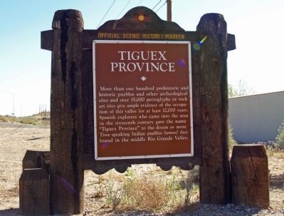
Tiguex Province
More the one hundred prehistoric and historic pueblos and other archeological sites and over 15,000 petroglyphs or rock art sites give ample evidence of the occupation of this valley for at least 12,000 years. Spanish explorers who came into the area in the sixteenth century gave the name “Tiguex Province” to the dozen or more Tiwa-speaking Indian pueblos (towns)they found in the middle of the Rio Grande Valley.
Erected by New Mexico Historic Preservation Division.
Topics. This historical marker is listed in this topic list: Native Americans.
Location. 35° 16.152′ N, 106° 37.427′ W. Marker is in Rio Rancho, New Mexico, in Sandoval County. Marker is at the intersection of Pat D'Arco Highway (State Road 528) and Alberta Ave/Rio Pinos Rd NE, on the right when traveling north on Pat D'Arco Highway. Touch for map. Marker is in this post office area: Rio Rancho NM 87144, United States of America. Touch for directions.
Other nearby markers. At least 8 other markers are within 6 miles of this marker, measured as the crow flies. Dulcelina Salce Curtis (1904-1995) (approx. 0.9 miles away); Iglesia de San Ysidro (approx. 2½ miles away); Spanish Entrada Site (approx. 3.1 miles away); Corrales (approx. 3.4 miles away); Alameda (approx. 4.3 miles away); Bernalillo (approx. 4.4 miles away); Vietnam War Memorial (approx. 5 miles away); a different marker also named Bernalillo (approx. 5½ miles away). Touch for a list and map of all markers in Rio Rancho.
Credits. This page was last revised on August 10, 2021. It was originally submitted on May 8, 2014, by Maribeth Robison of Moriarty, New Mexico. This page has been viewed 782 times since then and 26 times this year. Photo 1. submitted on May 8, 2014, by Maribeth Robison of Moriarty, New Mexico. • Bill Pfingsten was the editor who published this page.
Editor’s want-list for this marker. wide shot of this marker showing marker and its surroundings • Can you help?
