Parkersburg in Wood County, West Virginia — The American South (Appalachia)
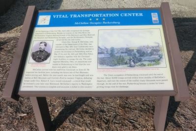
Vital Transportation Center
McClellan Occupies Parkersburg
Union Gen. George B. McClellan, commander of the Department of Ohio, was informed in May 1861 that Confederates were threatening the railroad. McClellan decided to protect the terminus at Parkersburg, and on May 27, he sent the 14th and 18th Ohio Volunteer Infantry, together with the Cleveland Light Artillery, to occupy the city. The units departed Marietta, Ohio, on steamboats and landed in Parkersburg to find the residents were glad to see them.
McClellan arrived with his staff from Cincinnati on June 22. He inspected the facilities here, including the future site of Fort Boreman, before moving east. Before the next month was over, he had fought and won battles at Rich Mountain and Corrick’s Ford in western Virginia, defeating troops under Gen. Robert E. Lee’s overall command—a trend that would be reversed a year later near Richmond. McClellan’s reports to Washington proclaimed, “Our success is complete and secession is killed in this country.”
The Union occupation of Parkersburg continued until the end of the war. About 30,000 troops arrived within three months of McClellan’s departure, and over the course of the conflict many thousands more passed through. At the end of the war, Parkersburg became a center for transporting troops west for discharge.
(captions)
(upper left) Gen. George B. McClellan Courtesy Library of Congress
(upper right) Union troops landing at Parkersburg, May 27, 1861, Frank Leslie’s Illustrated Newspaper, Aug. 24, 1861 Courtesy Blennerhassett Island Historical State Park
Erected by West Virginia Civil War Trails.
Topics and series. This historical marker is listed in this topic list: War, US Civil. In addition, it is included in the West Virginia Civil War Trails series list. A significant historical month for this entry is May 1861.
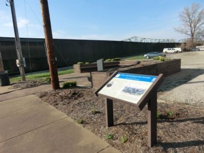
Location. 39° 15.973′ N, 81° 33.95′ W. Marker is in Parkersburg, West Virginia, in Wood County. Marker is on Little Kanawa Connector north of Ann Street, on the right when traveling north. The marker is located in Blennerhassett Point Park. Touch for map. Marker is in this post office area: Parkersburg WV 26101, United States of America. Touch for directions.
Other nearby markers. At least 8 other markers are within walking distance of this marker. Burr-Blennerhassett (here, next to this marker); Albert J. Woofter (a few steps from this marker); Escape to Freedom / Women of Courage (a few steps from this marker); Historic Blennerhassett Hotel (a few steps from this marker); George Rogers Clark (a few steps from this marker); Women of Courage (within shouting distance of this marker); General Thomas Jonathan "Stonewall" Jackson (within shouting distance of this marker); Railroads (within shouting distance of this marker). Touch for a list and map of all markers in Parkersburg.
Credits. This page was last revised on October 5, 2018. It was originally submitted on May 8, 2014, by Don Morfe of Baltimore, Maryland. This page has been viewed 460 times since then and 15 times this year. Photos: 1, 2. submitted on May 8, 2014, by Don Morfe of Baltimore, Maryland. • Bernard Fisher was the editor who published this page.

