Near Locust Grove in Orange County, Virginia — The American South (Mid-Atlantic)
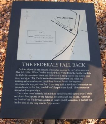
The Federals Fall Back
The armies rested uneasily behind their earthworks throughout May 7 while occasional fires, ignited by the fighting, swept through the woods. Although the Battle of the Wilderness resulted in nearly 30,000 casualties, it marked but the first step on the long road to Appomattox.
Topics. This historical marker is listed in this topic list: War, US Civil. A significant historical month for this entry is May 1777.
Location. 38° 19.425′ N, 77° 45.517′ W. Marker is near Locust Grove, Virginia, in Orange County. Marker can be reached from Constitution Highway (State Highway 20), on the right when traveling west. The marker is in Wilderness Battlefield at stop 9 of the Gordon Flank Attack trail, near Driving Tour Stop Two (the Exhibit Shelter). Touch for map. Marker is in this post office area: Locust Grove VA 22508, United States of America. Touch for directions.
Other nearby markers. At least 8 other markers are within walking distance of this marker. Morning of May 6 (approx. ¼ mile away); Gordon's Attack Falters (approx. ¼ mile away); Fighting on the Evening of May 5, 1864 (approx. 0.3 miles away); The Culpeper Mine Road (approx. 0.3 miles away); Gordon's Flank Attack (approx. 0.3 miles away); John Gordon Proposes a Flank Attack (approx. 0.4 miles away); Wilderness Battlefield Memorial (approx. 0.4 miles away); From Wilderness Run To Flat Run (approx. 0.4 miles away). Touch for a list and map of all markers in Locust Grove.
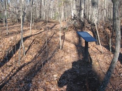
More about this marker. The upper half of the marker contains a map of the surrounding area detailing the trenches, and referencing the roads visible to the visitor.
Also see . . . Gordon Flank Attack Trail. National Park Service page detailing the Gordon Flank Attack Trail. (Submitted on April 27, 2008, by Craig Swain of Leesburg, Virginia.)
Credits. This page was last revised on June 16, 2016. It was originally submitted on April 27, 2008, by Craig Swain of Leesburg, Virginia. This page has been viewed 1,100 times since then and 26 times this year. Photos: 1, 2, 3. submitted on April 27, 2008, by Craig Swain of Leesburg, Virginia.


