Chester in Chesterfield County, Virginia — The American South (Mid-Atlantic)
Construction of the Howlett Line
The Bermuda Hundred Campaign
Construction of the Howlett Line
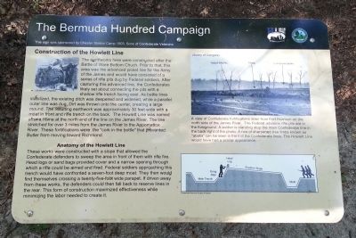
The earthworks here were constructed after the Battle of Ware Bottom Church. Prior to that, this area was the advanced picket line for the Army of the James and would have consisted of a series of rifle pits dug by Federal soldiers. After capturing this advanced line, the Confederates likely set about connecting the pits with a shallow rifle trench facing east. As battle lines stabilized, the existing ditch was deepened and widened, while a parallel outer line was dug. Dirt was thrown onto the center, creating a large mound. The resulting earthwork was approximately 30 feet wide with a moat in front and rifle trench on the back. The Howlett Line was named after a home at the north end of the line on the James River. The line stretched for over 3 miles from the James River to the Appomattox River. These fortifications were the “cork in the bottle” that prevented Butler from moving toward Richmond.
Anatomy of the Howlett Line
These works were constructed with a slope that allowed the Confederate defenders to sweep the area in front of them with rifle fire. Head logs or sand bags provided cover and a narrow opening through which a rifle could be aimed and fired. Federal soldiers approaching this trench would have confronted a seven-foot deep moat. They then would find themselves crossing a twenty-five-foot wide parapet. If driven away from these works, the defenders could then fall back to reserve lines in the rear. This form of construction maximized effectiveness while minimizing the labor needed to create if.
(caption)
A view of Confederate fortifications seen from Fort Harrison on the north side of the James River. The Federal advance rifle pits are in the foreground. A soldier is standing atop the main Confederate line in the back right of the photo. A row of sharpened tree limbs known as “abatis” can be seen in front of the Confederate lines. The Howlett Line would have had a similar appearance.
This sign was sponsored by Chester Station Camp 1503. Sons of Confederate Veterans
Erected 2014 by Chesterfield County and the Blue & Gray Education Society.
Topics and series. This historical marker is listed in this topic list: War, US Civil. In addition, it is included in the Sons of Confederate Veterans/United Confederate Veterans series list.
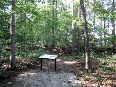
Location. 37° 20.65′ N, 77° 23.447′ W. Marker is in Chester, Virginia, in Chesterfield County. Marker can be reached from Old Bermuda Hundred Road east of Ramblewood Drive, on the right when traveling east. Located in Ware Bottom Church Battlefield Park. Touch for map. Marker is at or near this postal address: 1600 Old Bermuda Hundred Rd, Chester VA 23831, United States of America. Touch for directions.
Other nearby markers. At least 8 other markers are within walking distance of this marker. Howlett Line Gun Position (about 400 feet away, measured in a direct line); A Bomb Proof Church ? (about 500 feet away); The Battle of Ware Bottom Church (about 700 feet away); Parker's Battery (approx. 0.4 miles away); Remembrance (approx. 0.4 miles away); a different marker also named Parker’s Battery (approx. 0.4 miles away); Howlett Line (approx. 0.4 miles away); a different marker also named Howlett Line (approx. 0.4 miles away). Touch for a list and map of all markers in Chester.
Credits. This page was last revised on January 26, 2017. It was originally submitted on May 25, 2014, by Bernard Fisher of Richmond, Virginia. This page has been viewed 885 times since then and 29 times this year. Last updated on May 25, 2014, by Keith S Smith of West Chester, Pennsylvania. Photos: 1, 2. submitted on May 25, 2014, by Bernard Fisher of Richmond, Virginia.

