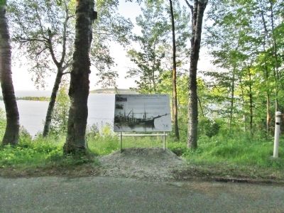
Near Sturgeon Bay in Door County, Wisconsin — The American Midwest (Great Lakes)
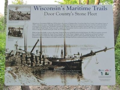
Door County's Stone Fleet
— Wisconsin's Maritime Trails —
With its limestone bluffs so close to water, Sturgeon Bay was an ideal location for this business. By 1898, four quarries operated here: Leathern and Smith, the Green Stone Company, the Laurie Stone Company, and the Termensen and Jensen Stone Company. Quarried stone was loaded onto ships moored nearby and economically carried to ports around Lake Michigan. By 1917 the breakwaters and piers of almost every harbor around Lake Michigan had been constructed in part with Sturgeon Bay limestone.
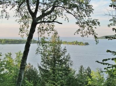
Looking across the mouth of Sturgeon Bay, you can see the massive footprint of the former Leathern and Smith quarry. Many of the quarry docks remain visible today. The remains of several ships from the stone fleet lie on the bottom of the bay near the piers.
logos of: Wisconsin Historical Society, Sea Grant · University of Wisconsin, Wisconsin Department of Transportation, Wisconsin State Park System, Wisconsin Department of Natural Resources
Title to Wisconsin's submerged archaeological sites is held in the public trust by the State of Wisconsin. As steward of these unique historical and recreational resources, the Wisconsin Historical Society encourages responsible visitation of these sites. Please leave these sites intact for future generations to enjoy. Wisconsin law prohibits unauthorized disturbance or removal of artifacts or structure.
www.maritimetrails.org
Erected by the Wisconsin Historical Society's Maritime Preservation and Archaeology Program.
Topics and series. This historical marker is listed in these topic lists: Industry & Commerce • Waterways & Vessels. In addition, it is included in the Wisconsin’s Maritime Trails series list. A significant historical year for this entry is 1834.
Location. 44° 52.621′ N, 87° 25.385′ W. Marker is near Sturgeon Bay, Wisconsin, in Door County. Marker can be reached from Park Drive (County Highway PD) 2.4 miles north of Green Bay Road (State Highway 42 / 57), on the right when traveling north. Marker is along North Norway Road in Potawatomi State Park. Fee area; a vehicle admission sticker is required. Touch for map. Marker is at or near this postal address: 3740 Park Drive, Sturgeon Bay WI 54235, United States of America. Touch for directions.
Other nearby markers. At least 8 other markers are within 4 miles of this marker, measured as the crow flies. Eastern Terminus Ice Age National Scenic Trail (approx. half a mile away); Leathem and Smith Quarry (approx. 2.1 miles away); Propeller and Shaft (approx. 2.1 miles away); Steam Barge Joys (approx. 2.7 miles away); Bradley Crandall Sawmill Site (approx. 3 miles away); Historic Sturgeon Bay (approx. 3.6 miles away); ‘Old Bell’ Tower (approx. 3.6 miles away); Hay Hardware (approx. 3.6 miles away). Touch for a list and map of all markers in Sturgeon Bay.
More about this marker. captions:
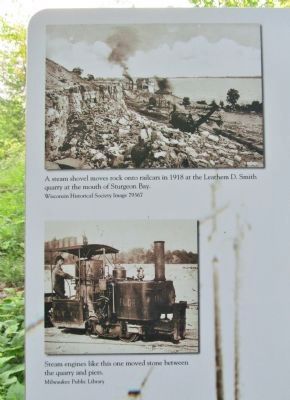
• A steam shovel moves rock onto railcars in 1918 at the Leathem D. Smith quarry at the mouth of Sturgeon Bay. Wisconsin Historical Society Image 79367
• Steam engines like this one moved stone between the quarry and piers. Milwaukee Public Library
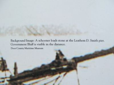
• Background Image: A schooner loads stone at the Leathem D. Smith pier. Government Bluff is visible in the distance. Door County Maritime Museum
Also see . . . Wisconsin's Great Lakes Shipwrecks. (Submitted on June 9, 2014.)
Credits. This page was last revised on October 15, 2021. It was originally submitted on June 9, 2014, by Keith L of Wisconsin Rapids, Wisconsin. This page has been viewed 650 times since then and 27 times this year. Photos: 1, 2, 3, 4, 5, 6, 7. submitted on June 9, 2014, by Keith L of Wisconsin Rapids, Wisconsin.
