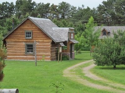
Forest City in Meeker County, Minnesota — The American Midwest (Upper Plains)
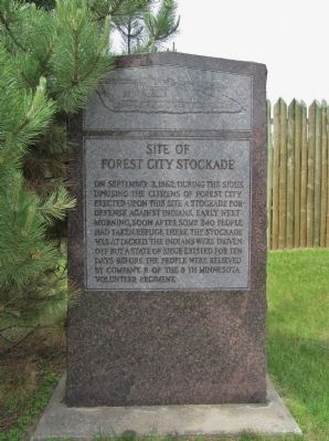
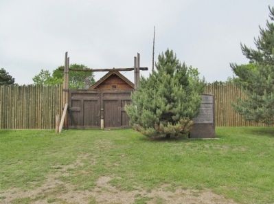
Site of Forest City Stockade
Topics. This historical marker is listed in these topic lists: Forts and Castles • Wars, US Indian. A significant historical month for this entry is September 1904.
Location. 45° 11.726′ N, 94° 27.751′ W. Marker is in Forest City, Minnesota, in Meeker County. Marker can be reached from 309th Street, 0.2 miles east of Minnesota Highway 24, on the left when traveling east. Touch for map. Marker is in this post office area: Litchfield MN 55355, United States of America. Touch for directions.
Other nearby markers. At least 8 other markers are within 10 miles of this marker, measured as the crow flies. Forest City War Memorial (approx. half a mile away); G.A.R. Hall (approx. 5˝ miles away); Grand Army of the Republic Hall / Litchfield's Historic Downtown (approx. 5.6 miles away); Civil War Monument (approx. 6.6 miles away); Legion Memorial Park (approx. 6.9 miles away); Kingston Veterans Memorial (approx. 7.3 miles away); Veterans Park (approx. 8˝ miles away); Eden Valley Veterans Memorial (approx. 9.7 miles away).
Regarding Site of Forest City Stockade. In August 1862, the Minnesota Dakota, also known by the French term, “Sioux," waged war against the United States following two years of unfulfilled treaty obligations. After attacking the Redwood (Lower Sioux) Agency, a remote government outpost, the Dakota moved with speed and surprise in southwestern Minnesota and what was then eastern Dakota Territory, killing nearly everyone in their path. They killed approximately 800 settlers and soldiers, took many prisoners, and caused extensive property damage throughout the Minnesota River Valley.
Also see . . .
1. Forest City Stockade. (Submitted on June 20, 2014.)
2. 1862 Dakota War. "It was the largest Indian war in American history. The main battleground was the entire Minnesota River Valley in southern and central Minnesota. The uprising spread into the Dakota Territories and sent panic into Nebraska, Iowa and Wisconsin.... To this day, [the] number of civilians killed on American soil as a result of hostile action is exceeded only by the attacks on 9/11." (Submitted on June 20, 2014.)
3. The US-Dakota War of 1862. Minnesota Historical Society. (Submitted on June 20, 2014.)
4. U.S.-Dakota War of 1862. Historic Fort Snelling. "Intermittent fighting continued between the U.S. military and the Dakota nation in the western territories throughout the late 1800s, culminating at Wounded Knee on Dec. 29, 1890." (Submitted on June 20, 2014.)
5. Dakota War of 1862. Wikipedia entry. (Submitted on June 20, 2014.)
Additional keywords. U.S.–Dakota War of 1862
Credits. This page was last revised on June 16, 2016. It was originally submitted on June 20, 2014, by Keith L of Wisconsin Rapids, Wisconsin. This page has been viewed 804 times since then and 29 times this year. Photos: 1, 2, 3, 4, 5. submitted on June 20, 2014, by Keith L of Wisconsin Rapids, Wisconsin.
