Near Fredericksburg in Spotsylvania County, Virginia — The American South (Mid-Atlantic)
Confederate Defense Turns to Offense
Battle of Chancellorsville - 1863
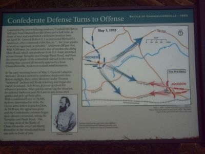
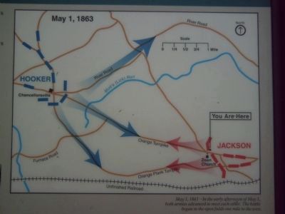
Confronted by overwhelming numbers, Confederate forces fell back from Chancellorsville (three and a half miles in front of you) and established a defensive position here on April 30. General Robert E. Lee instructed Richard H. Anderson, who commanded this line, to “…Set your spades to work as vigorously as possible.” Anderson did just that. With 9,100 men, he constructed a line of earthworks along Mine Road, which ran southeast from U.S. Ford, stretched across Orange Turnpike and Orange Plank Road, and then the crossed grade of the unfinished railroad to the south. Having thus covered all westerly approached from Chancellorsville, Anderson awaited reinforcements.
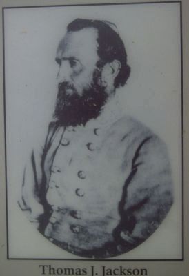
In the early morning hours of May 1, General Lafayette McLaws’ division arrived to reinforce Anderson’s line. Before daylight, three other divisions under Thomas “Stonewall” Jackson left Fredericksburg and began the march westward. At 8:30 am, Jackson reached this advanced position. After quickly surveying the situation, he ordered Anderson and McLaws to put down their spades and pick up their rifles. With a combined force of 36,500, Jackson determined to strike the Union army before it attacked him. At 10:30 am, the signal was given and the Confederate columns began their advance westward, taking the Turnpike and Plank Road. The opening clash of the Battle of Chancellorsville occurred shortly thereafter in the woods and fields one mile in front of you.
Topics. This historical marker is listed in this topic list: War, US Civil. A significant historical month for this entry is April 1879.
Location. 38° 17.62′ N, 77° 34.314′ W. Marker is near Fredericksburg, Virginia, in Spotsylvania County. Marker can be reached from Plank Road/Germanna Highway (Virginia Route 3) near Harrison Road. Touch for map. Marker is at or near this postal address: 5701 Plank Road, Fredericksburg VA 22407, United States of America. Touch for directions.
Other nearby markers. At least 8 other markers are within one mile of this marker, measured as the crow flies. McCarty Farm (here, next to this marker); Earthworks (about 400 feet away, measured in a direct line); Roads Through the Battlefield (about 500 feet away); Opening of the Campaign (about 500 feet away); Spotswood’s Furnace (about 800 feet away); First Day at Chancellorsville (approx. 0.9 miles away); 11th United States Infantry (approx. one mile away); a different marker also named First Day at Chancellorsville (approx. one mile away). Touch for a list and map of all markers in Fredericksburg.
Regarding Confederate Defense Turns to Offense. This marker is grouped with the markers along McLaws Drive, Furnace Road, Sickles Drive, East Jackson Trail, and others on the east side of the battlefield. See the First Days of the Battle of Chancellorsville
Virtual Tour by Markers in the links section for a listing of related markers on the tour.
Also see . . .
1. Battle of Chancellorsville. National Parks Service site. (Submitted on May 2, 2008, by Craig Swain of Leesburg, Virginia.)
2. First Days of the Battle of Chancellorsville Virtual Tour by Markers. This virtual tour by markers covers action from May 1-3, 1863. (Submitted on May 2, 2008, by Craig Swain of Leesburg, Virginia.)
Credits. This page was last revised on February 2, 2023. It was originally submitted on May 1, 2008, by Kevin W. of Stafford, Virginia. This page has been viewed 1,386 times since then and 26 times this year. Photos: 1, 2, 3, 4. submitted on May 1, 2008, by Kevin W. of Stafford, Virginia. • Craig Swain was the editor who published this page.


