Robbinsville in Graham County, North Carolina — The American South (South Atlantic)
Civil War in Graham County
Union and Confederate Raiders
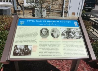
Confederate Capt. J.W. Cooperís Company H, 69th North Carolina Infantry, occupied Camp Cheoah on Rhea Hill, site of present-day Robbinsville Elementary School. Col. William H. Thomasís Legion, of which Cooperís company was a part, defended western North Carolina from Federal incursions. An engagement occurred here in November 1864 between Companies C and G of the 3rd Tennessee Mounted Infantry (U.S.) and Cherokee soldiers of Thomasís Legion.
The 3rd Tennessee Mounted Infantry consisted largely of Confederate and Union deserters. Several Kirkland family members joined but later operated independently here as the Kirkland Bushwhackers under John Jackson “Bushwhacking” Kirkland. His band of outlaws terrorized the area, ambushing, robbing, and murdering innocent people.
After the principal Confederate surrenders in April 1865, Maj. Stephen Whitaker of Thomasís Legion issued parole papers to Confederate troops here at Thomasís Store on May 14. They were among the last troops in North Carolina or east of the Mississippi River to surrender, eight days after one of the last engagements in the east on May 6 at Hanging Dog Creek in Cherokee County.
(captions)
(lower left) Cherokee veterans of Thomasís Legion at the 1903 Confederate Reunion in New Orleans. Courtesy The Mountaineer
(upper center) William H. Thomas Courtesy North Carolina Office of Archives and History; Stephen Whitaker Courtesy Bruce Whitaker
(upper right) Union bushwhackers attacking Confederate cavalrymen, engraving by Junius Henry Browne, 1865.
Erected by North Carolina Civil War Trails.
Topics and series. This historical marker is listed in this topic list: War, US Civil. In addition, it is included in the North Carolina Civil War Trails series list. A significant historical month for this entry is April 1865.
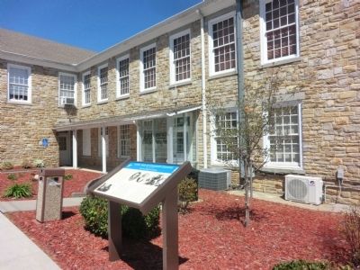
Location. 35° 19.378′ N, 83° 48.392′ W. Marker is in Robbinsville, North Carolina, in Graham County. Marker is at the intersection of East Main Street (County Route 1106) and Court Street, on the right when traveling west on East Main Street. The marker is on the grounds of the Graham County Jail. Touch for map. Marker is at or near this postal address: 11 Court Street, Robbinsville NC 28771, United States of America. Touch for directions.
Other nearby markers. At least 8 other markers are within walking distance of this marker. Junaluska (within shouting distance of this marker); Junaluska's Meeting With Tecumseh at Soco Gap (approx. ľ mile away); 1819 Treaty with the United States (approx. ľ mile away); Junaluska and The Battle of Horseshoe Bend (approx. ľ mile away); Junaluska's Names (approx. ľ mile away); Cherokee Chief Junaluska DAR Monument (approx. ľ mile away); Junaluska and the Trail of Tears (approx. ľ mile away); Junaluska's Birth Site (approx. ľ mile away). Touch for a list and map of all markers in Robbinsville.
Credits. This page was last revised on June 16, 2016. It was originally submitted on July 18, 2014, by Don Morfe of Baltimore, Maryland. This page has been viewed 952 times since then and 48 times this year. Photos: 1, 2. submitted on July 18, 2014, by Don Morfe of Baltimore, Maryland. • Bernard Fisher was the editor who published this page.

