Port Huron in St. Clair County, Michigan — The American Midwest (Great Lakes)
Seeing the Light
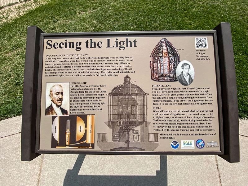
Evolution of Lighting the Way
It has long been documented that the first shoreline lights were wood burning fires set on hillsides. Later, these wood fires were moved to the top of man-made towers. Wood however proved to be inefficient, as it would burn rapidly, being very difficult to maintain. Candles offered a cleaner and less labor intensive solution, but were not as bright. The introduction of the oil lamp revolutionized lighthouse technology. The oil based lamps would be used well into the 20th century. Electricity would ultimately lead to automated lights, and the end for the need of a full time light keeper.
Lewis Lamp
In 1810, American Winslow Lewis patented an adaptation of the Argand lamp for use in the United States. Lewis increased the light by hanging many lamps together in chandeliers which could be rotated to provide a flashing light. By 1820 all 49 United States lighthouses were outfitted with Lewis Lamps.
Fresnel Lens
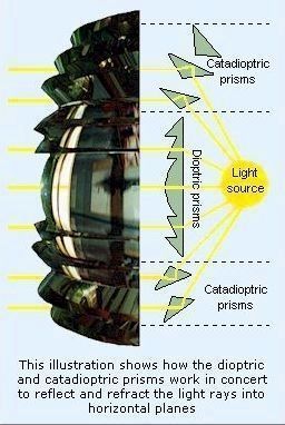
French physicist Augustin-Jean Fresnel developed a lens which surrounded a single lamp. A series of glass prisms would reflect and refract the light into a single beam, allowing it to be seen from greater distances. In the 1850's, the Lighthouse Service decided to use the new technology in all its lighthouses.
Fuels
When oil lamps were introduced, whale oil was the fuel used in almost all lighthouses. Its demand however, led to higher costs, and the search for cheaper alternative. Various oils were tested, and lard oil proved to be the most economical and became the most utilized. Lard oil however did not burn cleanly, and would soon be replaced by the cleaner burning mineral oil (kerosene). Mineral oil would be used until the introduction of electric lights.
Erected by Port Huron Museum, Saint Clair County, Michigan Dept of Environmental Quality, and NOAA.
Topics and series. This historical marker is listed in these topic lists: Communications • Waterways & Vessels. In addition, it is included in the Lighthouses series list. A significant historical year for this entry is 1810.
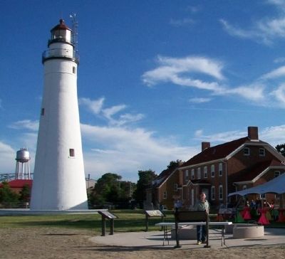
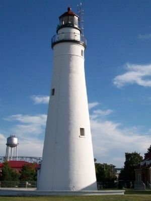
Location. 43° 0.4′ N, 82° 25.347′ W. Marker is in Port Huron, Michigan, in St. Clair County. Marker is about 125 feet north of the lighthouse at Fort Gratiot Light Station County Park, where Lake Huron empties into the St. Clair River. Touch for map. Marker is at or near this postal address: 2800 Omar Street, Port Huron MI 48060, United States of America. Touch for directions.
Other nearby markers. At least 8 other markers are within walking distance of this marker. The Storm (here, next to this marker); Learning from Lake Huron (here, next to this marker); Sending a Signal (here, next to this marker); Keepers Duties (here, next to this marker); Fort Gratiot Light (here, next to this marker); U.S. Coast Guard (about 500 feet away, measured in a direct line); a different marker also named Fort Gratiot Light (about 500 feet away); Great Storm of 1913 and Sailors Memorial (approx. 0.4 miles away). Touch for a list and map of all markers in Port Huron.
Also see . . .
1. Fort Gratiot Light Station: A St. Clair County Park. Park brochure PDF (Submitted on August 8, 2014, by William Fischer, Jr. of Scranton, Pennsylvania.)
2. Fort Gratiot Lighthouse. Port Huron Museums website entry (Submitted on August 8, 2014, by William Fischer, Jr. of Scranton, Pennsylvania.)
3. The incredible Fresnel lens: A brief history and technical explanation. Seeing the Light website entry (Submitted on August 8, 2014, by William Fischer, Jr. of Scranton, Pennsylvania.)
Credits. This page was last revised on July 3, 2023. It was originally submitted on August 8, 2014, by William Fischer, Jr. of Scranton, Pennsylvania. This page has been viewed 369 times since then and 24 times this year. Photos: 1. submitted on August 21, 2022, by J.T. Lambrou of New Boston, Michigan. 2, 3, 4. submitted on August 8, 2014, by William Fischer, Jr. of Scranton, Pennsylvania. 5. submitted on March 1, 2022, by Larry Gertner of New York, New York.
