Fredericksburg, Virginia — The American South (Mid-Atlantic)
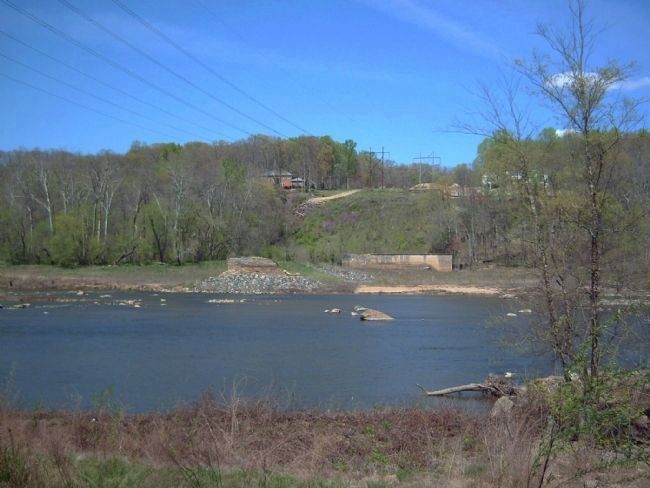
Embrey Dam
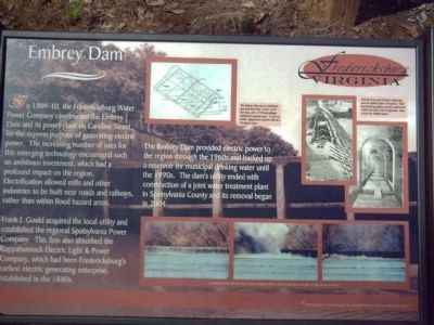
In 1909-10, the Fredericksburg Water Power Company constructed the Embrey Dam and its power plant on Caroline Street, for the express purpose of generating electric power. The increasing number of uses for this emerging technology encouraged such an ambitious investment, which had profound impact on the region. Electrification allowed mills and other industries to be built near roads and railways, rather than within flood hazard areas.
Frank J. Gould acquired the local utility and established the regional Spotsylvania Power Company. The firm also absorbed the Rappahannock Electric Light & Power Company, which had been Fredericksburg’s earliest electric generating enterprise, established in the 1880s.
The Embrey Dam provided electric power to the region through the 1960s and backed up a reservoir for municipal drinking water until the 1990s. The dam’s utility ended with construction of a joint water treatment plant in Spotsylvania County and its removal began in 2004.
Topics. This historical marker is listed in these topic lists: Industry & Commerce • Waterways & Vessels. A significant historical year for this entry is 2004.
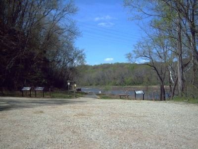
Location. 38° 19.254′ N, 77° 29.38′ W. Marker is in Fredericksburg, Virginia. Marker can be reached from Fall Hill Avenue near Normandy Avenue. Marker is along a recreational trail leading to the Rappahannock River. Touch for map. Marker is in this post office area: Fredericksburg VA 22401, United States of America. Touch for directions.
Other nearby markers. At least 8 other markers are within walking distance of this marker. Falls of the Rappahannock River (here, next to this marker); The Rappahannock River Runs Free Once More (a few steps from this marker); A Once Promising Canal Becomes a Raceway (approx. 0.3 miles away); Confederate Defenses in December 1862 (approx. 0.4 miles away); Fall Hill Road (approx. 0.4 miles away); Tactical Terrain (approx. 0.4 miles away); Confederate and Federal Defenses in May 1863 (approx. 0.4 miles away); Rappahannock River Heritage Trail (approx. 0.4 miles away). Touch for a list and map of all markers in Fredericksburg.
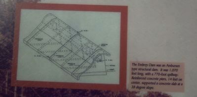
More about this marker. Several photographs adorn the marker. At the top center is an illustration of a cross section of the Embrey Dam. Its caption reads, "The Embrey Dam was an Ambursen type structural dam. It was 1,070 feet long, with a 770-foot spillway. Reinforced concrete piers, 14 feet on center, supported a concrete slab at a 38 degree slope."
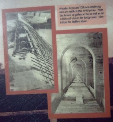
At the top right of the marker are two pictures of the dam under construction. Its caption reads, "Wooden forms and 7/8 inch reinforcing bars are visible in this 1910 photo. Note the formed up gallery arches as well as the 1850s crib dam in the background.
View is from the Stafford shore."
At the bottom right of the marker is a series of three photos during the first stage of its removal. The caption reads, "In February 2004, the U.S. Army Corps of Engineers blew a 100-foot wide hole in the dam as a first step in its removal."
The marker's photography and design are credited to Daniel Fitzpatrick and Pamella Hunt.
Credits. This page was last revised on February 2, 2023. It was originally submitted on May 7, 2008, by Kevin W. of Stafford, Virginia. This page has been viewed 2,849 times since then and 112 times this year. Photos: 1, 2, 3, 4, 5. submitted on May 7, 2008, by Kevin W. of Stafford, Virginia.
