Rodanthe in Dare County, North Carolina — The American South (South Atlantic)
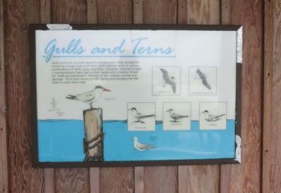
Gulls and Terns
Gulls and terns are both found in coastal areas, and, sometimes inland near large lakes and rivers. Both species occur in various combinations of white, gray, and black. However, most terns have a distinguishable black cap on their heads and a sharply forked tail. Gulls are scavengers, feeding on fish, insects, berries and garabage. Terns feed mainly on fish, diving and plunging into the water to catch their meal.
(captions)
Forster's Tern, Royal Tern, Laughing Gull, Great Black-backed Gull, Common Tern, Caspian Tern, Least Tern, Herring Gull
Topics. This historical marker is listed in these topic lists: Animals • Environment.
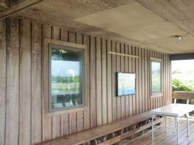
Location. 35° 43′ N, 75° 29.62′ W. Marker is in Rodanthe, North Carolina, in Dare County. Marker is on State Highway 12, 4 miles south of Lifeboat Station Road, on the left when traveling south. The marker is mounted on the exterior wall of the Pea Island National Wildlife Refuge Visitor Center. Touch for map. Marker is in this post office area: Rodanthe NC 27968, United States of America. Touch for directions.
Other nearby markers. At least 8 other markers are within 9 miles of this marker, measured as the crow flies. Fish & Wildlife Service (a few steps from this marker); Pea Island Lifesavers (within shouting distance of this marker); Charles Kuralt Trail (about 300 feet away, measured in a direct line); Giant Bluefin Tuna (approx. 6.3 miles away); Mirlo Rescue (approx. 8 miles away); Bodie Island Lighthouse (approx. 8.1 miles away); All for Safe Passage (approx. 8.1 miles away); Bodie Island Light Station (approx. 8.1 miles away). Touch for a list and map of all markers in Rodanthe.
Credits. This page was last revised on June 16, 2016. It was originally submitted on September 1, 2014, by Don Morfe of Baltimore, Maryland. This page has been viewed 385 times since then and 6 times this year. Photos: 1, 2. submitted on September 1, 2014, by Don Morfe of Baltimore, Maryland. • Bernard Fisher was the editor who published this page.

