Deep Creek North in Chesapeake, Virginia — The American South (Mid-Atlantic)
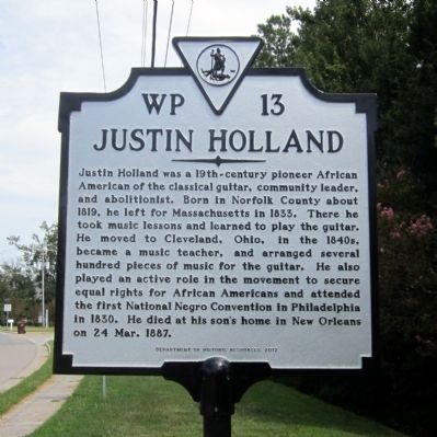
Justin Holland
Erected 2012 by Department of Historic Resources. (Marker Number WP-13.)
Topics and series. This historical marker is listed in these topic lists: Abolition & Underground RR • African Americans • Arts, Letters, Music. In addition, it is included in the Virginia Department of Historic Resources (DHR) series list. A significant historical date for this entry is March 24, 1887.
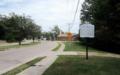
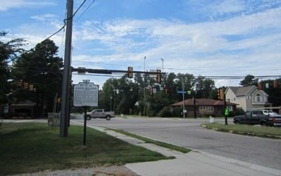
Location. 36° 45.047′ N, 76° 20.735′ W. Marker is in Chesapeake, Virginia. It is in Deep Creek North. Marker is at the intersection of Shell Road and George Washington Highway (Business U.S. 17), on the right when traveling east on Shell Road. Touch for map. Marker is in this post office area: Chesapeake VA 23323, United States of America. Touch for directions.
Other nearby markers. At least 8 other markers are within 5 miles of this marker, measured as the crow flies. Village of Deep Creek (approx. 0.4 miles away); Owens-Melvin House (approx. 0.7 miles away); Cody S. Childers (approx. 3 miles away); Site of the Nansemond Indian Public School #9 (approx. 3.8 miles away); Sunray (approx. 4.2 miles away); Dale Point (approx. 4.3 miles away); Great Dismal Swamp National Wildlife Refuge (approx. 4˝ miles away); Dismal Swamp Canal Trail (approx. 4.7 miles away). Touch for a list and map of all markers in Chesapeake.
Credits. This page was last revised on February 1, 2023. It was originally submitted on September 2, 2014, by Bernard Fisher of Richmond, Virginia. This page has been viewed 1,291 times since then and 65 times this year. Photos: 1, 2, 3. submitted on September 2, 2014, by Bernard Fisher of Richmond, Virginia.


