Hope Village in Portsmouth, Virginia — The American South (Mid-Atlantic)
Norfolk Naval Shipyard
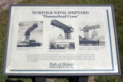
“Hammerhead Crane”
— Path of History Portsmouth, VA —
(captions)
(left) Hammerhead crane 110 easily loaded this tug on the USS Tarheel Mariner in April 1953.
(center) Hammerhead crane 110 hoists a 16-inch gun turret destined for action aboard the battleship Alabama.
(right) The guided missile cruiser Long Beach, the first nuclear powered surface warship in the world, arrived at NNSY in January 1964 for a post-shakedown availability.
Topics. This historical marker is listed in these topic lists: Industry & Commerce • Waterways & Vessels. A significant historical month for this entry is January 1964.
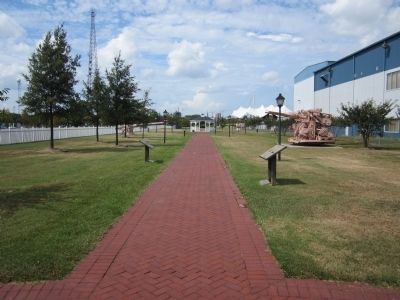
Location. 36° 49.663′ N, 76° 17.823′ W. Marker is in Portsmouth, Virginia. It is in Hope Village. Marker can be reached from Lincoln Street east of 3rd Street, on the left when traveling east. Located in Gosport Park. Touch for map . Marker is in this post office area: Portsmouth VA 23704, United States of America. Touch for directions.
Other nearby markers. At least 8 other markers are within walking distance of this marker. A different marker also named Norfolk Naval Shipyard (a few steps from this marker); a different marker also named Norfolk Naval Shipyard (a few steps from this marker); a different marker also named Norfolk Naval Shipyard (a few steps from this marker); a different marker also named Norfolk Naval Shipyard (within shouting distance of this marker); a different marker also named Norfolk Naval Shipyard (within shouting distance of this marker); a different marker also named Norfolk Naval Shipyard (within shouting distance of this marker); Sail portion of the USS Thomas Jefferson (within shouting distance of this marker); a different marker also named Norfolk Naval Shipyard (within shouting distance of this marker). Touch for a list and map of all markers in Portsmouth.
Credits. This page was last revised on October 26, 2023. It was originally submitted on September 2, 2014, by Bernard Fisher of Richmond, Virginia. This page has been viewed 1,637 times since then and 247 times this year. Photos: 1. submitted on September 2, 2014, by Bernard Fisher of Richmond, Virginia. 2. submitted on September 3, 2014, by Bernard Fisher of Richmond, Virginia.

