Seminary Hill in Alexandria, Virginia — The American South (Mid-Atlantic)
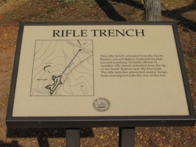
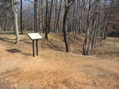
Rifle Trench
Erected by City of Alexandria.
Topics and series. This historical marker is listed in these topic lists: Forts and Castles • War, US Civil. In addition, it is included in the Defenses of Washington, and the Virginia, The City of Alexandria series lists.
Location. 38° 49.879′ N, 77° 6.093′ W. Marker is in Alexandria, Virginia. It is in Seminary Hill. Marker can be reached from West Braddock Road, on the right when traveling west. Located in Fort Ward Historic Site. Touch for map. Marker is at or near this postal address: 4301 West Braddock Road, Alexandria VA 22304, United States of America. Touch for directions.
Other nearby markers. At least 8 other markers are within walking distance of this marker. Profile of Fort (within shouting distance of this marker); Northwest Bastion (about 300 feet away, measured in a direct line); Powder Magazine and Filling Room (about 300 feet away); Bombproof (about 500 feet away); Fort Ward (about 500 feet away); The Oakland Baptist Church (about 500 feet away); Oakland Baptist Church Cemetery (about 600 feet away); Jackson Cemetery (about 600 feet away). Touch for a list and map of all markers in Alexandria.
More about this marker. On the left is an engineering plan over laying a topographical map, indicating the location of the infantry trenches and several outer works associated with Fort Ward.
Also see . . . Fort Ward Historic Site. (Submitted on May 15, 2008, by Craig Swain of Leesburg, Virginia.)
Credits. This page was last revised on January 27, 2023. It was originally submitted on May 15, 2008, by Craig Swain of Leesburg, Virginia. This page has been viewed 2,428 times since then and 33 times this year. Photos: 1, 2. submitted on May 15, 2008, by Craig Swain of Leesburg, Virginia.

