Lawrence in Douglas County, Kansas — The American Midwest (Upper Plains)
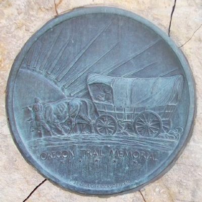
California and Oregon Trails Memorial
Inscription.
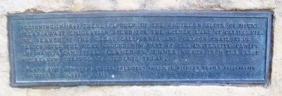
Beginning in 1849, there plodded up the southern slope of Mount Oread a vast emigration bound for the golden land of California. One branch of the great California and Oregon Trail thus passed over the very ground now part of the university campus and many a camp fire gleamed on summer nights from the crest where now throngs of students tread.
Plaque by Dr. Howard R. Driggs, President American Pioneer Trails Association
Setting by Class of 1916
Erected by Dr. Howard R. Driggs and University of Kansas Class of 1916.
Topics. This historical marker and memorial is listed in these topic lists: Roads & Vehicles • Settlements & Settlers. A significant historical year for this entry is 1849.
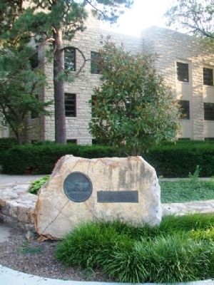
Location. 38° 57.527′ N, 95° 15.068′ W. Marker is in Lawrence, Kansas, in Douglas County. Marker is at the intersection of Crescent Road and West Campus Road, on the right when traveling east on Crescent Road. Marker is adjacent to Lindley Hall, on the University of Kansas campus. Touch for map. Marker is in this post office area: Lawrence KS 66045, United States of America. Touch for directions.
Other nearby markers. At least 8 other markers are within walking distance of this marker. Korean War Memorial (about 400 feet away, measured in a direct line); World War II Memorial Campanile (approx. ¼ mile away); Forrest "Phog" Clare Allen (approx. 0.3 miles away); The Victory Eagle (approx. 0.4 miles away); Pioneer Cemetery (approx. 0.7 miles away); Unknown Dead (approx. 0.7 miles away); The Castle Tea Room (approx. 0.8 miles away); South Park (approx. 0.8 miles away). Touch for a list and map of all markers in Lawrence.
Also see . . .
1. Oregon-California Trails Association. (Submitted on September 29, 2014, by William Fischer, Jr. of Scranton, Pennsylvania.)
2. California National Historic Trail. (Submitted on September 29, 2014, by William Fischer, Jr. of Scranton, Pennsylvania.)
3. Oregon National Historic Trail. (Submitted on September 29, 2014, by William Fischer, Jr. of Scranton, Pennsylvania.)
Credits. This page was last revised on June 16, 2016. It was originally submitted on September 29, 2014, by William Fischer, Jr. of Scranton, Pennsylvania. This page has been viewed 582 times since then and 20 times this year. Photos: 1, 2, 3. submitted on September 29, 2014, by William Fischer, Jr. of Scranton, Pennsylvania.


