Randolph in Coos County, New Hampshire — The American Northeast (New England)
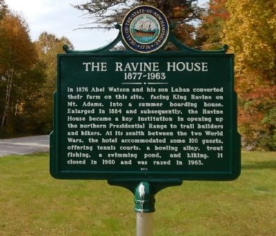
The Ravine House
1877-1963
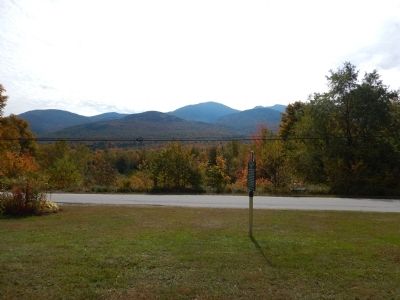
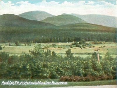
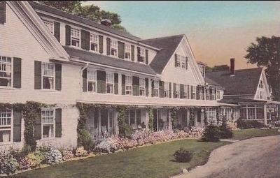
In 1876 Abel Watson and his son Laban converted their farm on this site, facing King Ravine on Mt. Adams, into a summer boarding house. Enlarged in 1884 and subsequently, the Ravine House became a key institution in opening up the northern Presidential Range to trail builders and hikers. At its zenith between the two World Wars, the hotel accommodated some 100 guests, offering tennis courts, a bowling alley, trout fishing, a swimming pond, and hiking. It closed in 1960 and was razed in 1963.
Erected 2010 by New Hampshire Division of Historical Resources. (Marker Number 220.)
Topics and series. This historical marker is listed in these topic lists: Environment • Industry & Commerce. In addition, it is included in the New Hampshire Historical Highway Markers series list. A significant historical year for this entry is 1876.
Location. 44° 22.46′ N, 71° 17.43′ W. Marker is in Randolph, New Hampshire, in Coos County. Marker is on Durand Road East, on the right when traveling west. Touch for map. Marker is in this post office area: Randolph NH 03593, United States of America. Touch for directions.
Other nearby markers. At least 8 other markers are within 10 miles of this marker, measured as the crow flies. Presidential Range (approx. 6.7 miles away); Northern Peaks of Presidential Range (approx. 7.2 miles away); Mount Washington Summit (approx. 7.2 miles away); The Old Hero (approx. 7.8 miles away); Mount Washington Cog Railway (approx. 8 miles away); First Ascent of Mount Washington (approx. 8.1 miles away); Granny Stalbird (approx. 9.4 miles away); Cherry Mountain Slide (approx. 9.8 miles away).
More about this marker. Durand Road is a quiet country lane that runs parallel to US-2 for 3.4 miles.
Also see . . . North Country Chronicles - The Ravine House - a closer look. (Submitted on October 2, 2014, by Kevin Craft of Bedford, Quebec.)
Credits. This page was last revised on June 16, 2016. It was originally submitted on October 2, 2014, by Kevin Craft of Bedford, Quebec. This page has been viewed 710 times since then and 73 times this year. Photos: 1, 2. submitted on October 2, 2014, by Kevin Craft of Bedford, Quebec. 3, 4. submitted on September 19, 2015. • Bill Pfingsten was the editor who published this page.


