Atchison in Atchison County, Kansas — The American Midwest (Upper Plains)
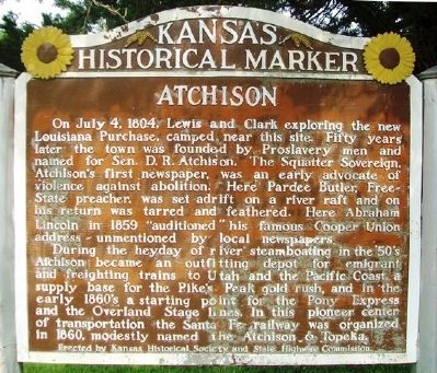
Atchison
On July 4, 1804, Lewis and Clark exploring the new Louisiana Purchase, camped near this site. Fifty years later the town was founded by Proslavery men and named for Sen. D. R. Atchison. The Squatter Sovereign, Atchison's first newspaper, was an early advocate of violence against abolition. Here Pardee Butler, Free- State preacher, was set adrift on a river raft and on his return was tarred and feathered. Here Abraham Lincoln in 1859 "auditioned" his famous Cooper Union address ~ unmentioned by local newspapers.
During the heyday of river steamboating in the '50s Atchison became an outfitting depot for emigrant and freighting trains to Utah and the Pacific Coast, a supply base for the Pike's Peak gold rush, and in the early 1850's a starting point for the Pony Express and the Overland Stage lines. In this pioneer center of transportation the Santa Fe railway was organized in 1860, modestly named the Atchison & Topeka.
Erected by Kansas Historical Society and State Highway Commission. (Marker Number 11.)
Topics and series. This historical marker is listed in these topic lists: Abolition & Underground RR • Exploration • Railroads & Streetcars • Settlements & Settlers. In addition, it is included in the Kansas Historical Society series list. A significant historical date for this entry is July 4, 1804.
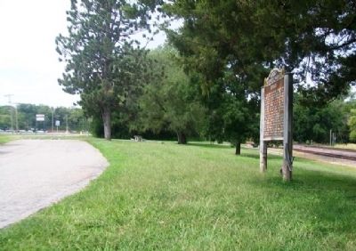
Location. 39° 33.402′ N, 95° 8.754′ W. Marker is in Atchison, Kansas, in Atchison County. Marker is on Skyway Highway (U.S. 59) 0.2 miles west of Rawlins Road, on the right when traveling west. Marker is at a roadside pullout. Touch for map. Marker is in this post office area: Atchison KS 66002, United States of America. Touch for directions.
Other nearby markers. At least 8 other markers are within 2 miles of this marker, measured as the crow flies. Birthplace of the Santa Fe Railway Company (approx. one mile away); Working Men of the Railroads (approx. one mile away); 4th of July, 1804 Creek (approx. 1.1 miles away); The Bridge Over 4th of July 1804 Creek (approx. 1.1 miles away); Frank R. Firth (approx. 1.1 miles away); John Alexander Martin (approx. 1.2 miles away); Mount Saint Scholastica Monastery (approx. 1.2 miles away); Atchison County World War I Memorial (approx. 1.2 miles away). Touch for a list and map of all markers in Atchison.
Also see . . .
1. Atchison, Kansas. (Submitted on October 11, 2014, by William Fischer, Jr. of Scranton, Pennsylvania.)
2. Atchison County, Kansas. (Submitted on October 11, 2014, by William Fischer, Jr. of Scranton, Pennsylvania.)
3. Atchison County, Kansas, in Cutler's History (1883). (Submitted on October 11, 2014, by William Fischer, Jr. of Scranton, Pennsylvania.)
Credits. This page was last revised on June 16, 2016. It was originally submitted on October 11, 2014, by William Fischer, Jr. of Scranton, Pennsylvania. This page has been viewed 648 times since then and 28 times this year. Photos: 1, 2. submitted on October 11, 2014, by William Fischer, Jr. of Scranton, Pennsylvania.

