Near Shabbona in DeKalb County, Illinois — The American Midwest (Great Lakes)
Chief Shabbona
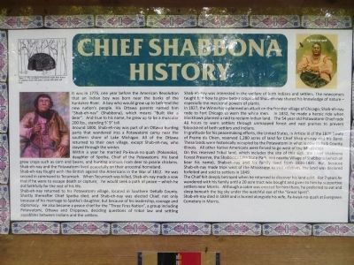
It was 1775, one year before the American Revolution that an Indian boy was born near the banks of the Kankakee River. A boy who would grow up to befriend the new nation's people. His Ottawa parents named him “Shab-eh-nay” (Shabbona), which means “Built like a Bear”. And true to his name, he grew up to be a muscular 200 lbs., standing 5'9” tall.
Around 1800, Shab-eh-ney was part of an Ottawa hunting party that wandered into a Potawatomi camp near the southern shore of Lake Michigan. All of the Ottawa returned to their own village, except Shab-eh-nay, who stayed through the winter.
Within a year he married Pa-kwuk-no-quah (Pokanoka), daughter of Spotka, Chief of the Potawatoni. His band grew crops such as corn and beans, and hunting animals from deer to prairie chickens. Shab-eh-nay and the Potawatomi lived peacefully on their ancestral homeland.
Shab-eh-nay fought with the British against the Americans in the War of 1812. He was second in command to Tecumseh. When Tecumseh was killed, Shab-eh-nay made a vow that if he were to escape death or capture; he would seek a path of peace – which he did faithfully for the rest of his life.
Shab-eh-ney returned to his Potawatomi village, located in Southern DeKalb County. Shortly thereafter Chief Spotka died, and Shab-eh-nay was elected Chief, not only because of his marriage to Spotka's daughter, but because of his leadership, courage and diplomacy. He also became a peace chief for the “Three Fires Nation”, a group including Potawatomi, Ottawa and Chippewa, deciding questions of tribal law and settling squabbles between Indians and the settlers.
Shab-eh-nay was interested in the welfare of both Indians and settlers. The newcomers taught him how to grow better crops and Shab-eh-nay shared his knowledge of nature – especially the medicinal powers of plants.
In 1827, the Winnebago planned an attack on the frontier village of Chicago; Shab-eh-nay rode to Fort Chicago to warn the white men. In 1832, he made a heroic ride when Blackhawk planned a raid to reclaim Indian land. The 54 year old Potawatomi Chief rode 48 hours to warn settlers through unmapped forest and vast prairies to prevent bloodshed of both settlers and Indians.
In gratitude for his peacemaking efforts, the United States, in Article III of the 1829 Treaty of Prairie du Chien, reserved 1,280 acres of land for Chief Shab-eh-nay and his Band. These lands were historically occupied by the Potawatomi in what is now DeKalb County, Illinois. All other Native Americans were forced to go west of the Mississippi.
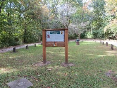
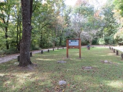
On this reserved Tribal land, which includes the site of this sign, the Chief Shabbona Forest Preserve, the Shabbona Lake State Park, and nearby Village of Shabbona (which all bear his name), Shab-eh-nay and his family lived from 1836-1845. But, because Shab-eh-nay made trips west of the Mississippi to visit relatives, the land was declared forfeited and sold to settlers in 1849.
The Chief felt deeply betrayed when he returned to discover his land sold. For 7 years he wandered with his family until a 20 acre tract was bought and given to him by supportive settlers near Morris. Although a cabin was erected for him there, he preferred to eat and sleep beneath the big sky under the watchful eye of the “Great Spirit”.
Shab-eh-nay died in 1859 and is buried alongside his wife, Pa-kwuk-no-quah at Evergreen Cemetery in Morris.
Topics and series. This historical marker is listed in this topic list: Native Americans. In addition, it is included in the Black Hawk War series list. A significant historical year for this entry is 1775.
Location. 41° 45.375′ N, 88° 51.258′ W. Marker is near Shabbona, Illinois, in DeKalb County. Marker can be reached from Chief Shabbona County Forest Preserve, half a mile south of Preserve Road. Touch for map. Marker is at or near this postal address: 8519 University Road, Shabbona IL 60550, United States of America. Touch for directions.
Other nearby markers. At least 8 other markers are within 13 miles of this marker, measured as the crow flies. Shabbona (approx. 0.9 miles away); Homes of Chief Waubonsie and Madeline Ogee (approx. 8.1 miles away); Bicentennial Grove (approx. 8.2 miles away); Old Chicago Trail (approx. 8.3 miles away); Malta (approx. 12.1 miles away); Lincoln Highway Seedling Mile (approx. 12.6 miles away); Illinois Lincoln Highway (approx. 12.6 miles away); Lincoln Highway (approx. 12.6 miles away).
Also see . . . Chief Benjamin Shabbona. From Find-A-Grave (Submitted on March 27, 2017, by Steve Masler of Memphis, Tennessee.)
Credits. This page was last revised on August 22, 2022. It was originally submitted on October 25, 2014, by Bill Kirchner of Tucson, Arizona. This page has been viewed 1,442 times since then and 108 times this year. Photos: 1, 2, 3. submitted on October 25, 2014, by Bill Kirchner of Tucson, Arizona. 4. submitted on August 21, 2022, by Trevor L Whited of Kokomo, Indiana. • Al Wolf was the editor who published this page.


