Annapolis Royal in Annapolis County, Nova Scotia — The Atlantic Provinces (North America)
Cemeteries
Les Cimetières

Photographed By Barry Swackhamer, June 17, 2014
1. Cemeteries Marker
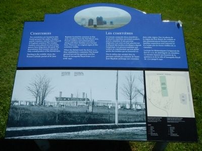
Captions (English / French): (bottom left) A view of the cemetery taken in the late 1800s. / Vue du cimetière prise à la fin des années 1800.; (bottom right) Approximate location of the Acadian cemetery based on early maps. / Emplacement approximatif du cimetière acadien selon des cartes anciennes.
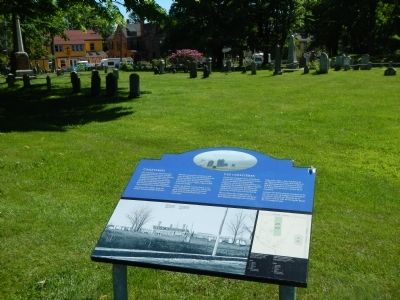
Two cemeteries are located in this burial ground: the earlier Acadian parish cemetery and the later Church of England cemetery. The wooden markers once placed on most of the graves have long since decayed. The gravestones that remain represent only a small portion of the burials here.
Starting in the middle 1600s, the Roman Catholic parish of St. Jean Baptiste located its cemetery in this area. Acadians from the Port-Royal area, French soldiers and administrators along with their families were buried here. There are no original signs of this cemetery visible.
When the British took the fort in 1710, they established a cemetery. This burial ground served the garrison and the Town of Annapolis Royal from 1710 until 1940.
French
Ce terrain comporte deux cimetières: d’abord le cimetière paroissial acadien, puis le cimetière d’une paroisse anglicane. Les croix en bois placées sur la plupart des tombes ont disparu depuis longtemps. Les pierres tombales qui restent ne représentent qu’une petite partier des tombes qui se trouvent ici.
Dès le milieu des années 1600, la paroisse catholique romaine de Saint-Jean-Baptiste aménagé son cimetière dans cette région. Des Acadiens de la région de Port-Royal, des soldats et des administrateurs français et leur familles respectives sont enterrés ici. Il n’existe pas de traces visibles de ce cimetière.
Lorsque les Britanniques s’emparent du fort en 1710, ils aménagent un cimetière. Ce terrain répond aux besoins de la garnison et la ville d’Annapolis Royal de 1710 jusqu’à 1940.
Erected by Parks Canada.
Topics and series. This historical marker is listed in these topic lists: Cemeteries & Burial Sites • Forts and Castles. In addition, it is included in the Acadian History series list. A significant historical year for this entry is 1710.
Location. 44° 44.512′ N, 65° 31.051′ W. Marker is in Annapolis Royal, Nova Scotia, in Annapolis County. Marker can be reached from St. George Street close to St. Anthony Street, on the left when traveling west. Touch for map. Marker is at or near this postal address: 323 St George Street, Annapolis Royal NS B0S, Canada. Touch for directions.
Other nearby markers. At least 8 other markers are within walking distance of this marker. Duvivier Attack (within shouting distance of this marker); Daniel Auger de Subercase (within shouting distance of this marker); Captures of Port Royal (about 90 meters away, measured in a direct line); William Wolseley (about 120 meters away); Fort Anne, a Bastioned Fort (about 150 meters away); Sieur de Monts (about 150 meters away); The Black Hole / Le cachot (about 150 meters away); Queen’s Wharf (about 150 meters away). Touch for a list and map of all markers in Annapolis Royal.
More about this marker. This marker is located on the grounds of Fort Anne National Historic Site.
Credits. This page was last revised on June 16, 2016. It was originally submitted on November 3, 2014, by Barry Swackhamer of Brentwood, California. This page has been viewed 579 times since then and 24 times this year. Photos: 1, 2. submitted on November 3, 2014, by Barry Swackhamer of Brentwood, California. • Andrew Ruppenstein was the editor who published this page.
