Stillwater in Washington County, Minnesota — The American Midwest (Upper Plains)
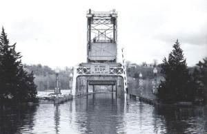
1965 Easter Sunday Floodwater Crest
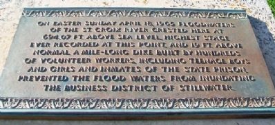
On Easter Sunday April 18, 1965 floodwaters of the St. Croix River crested here at 694.07 ft. above sea level, highest stage ever recorded at this point, and 19 ft. above normal. A mile-long dike built by hundreds of volunteer workers, including teenage boys and girls and inmates of the state prison prevented the flood waters from inundating the business district of Stillwater.
Topics. This historical marker is listed in these topic lists: Industry & Commerce • Settlements & Settlers • Waterways & Vessels. A significant historical date for this entry is April 18, 1773.
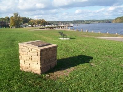
Location. 45° 3.423′ N, 92° 48.275′ W. Marker is in Stillwater, Minnesota, in Washington County. Marker is at the intersection of Myrtle Street and the St. Croix Riverfront, on the left when traveling east on Myrtle Street. Marker is near the park pavilion. Touch for map. Marker is at or near this postal address: Lowell Park, Stillwater MN 55082, United States of America. Touch for directions.
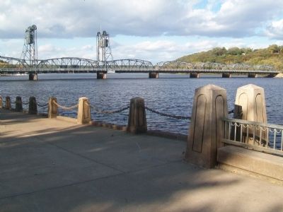
Other nearby markers. At least 8 other markers are within walking distance of this marker. Lumbermen's Exchange Building (about 400 feet away, measured in a direct line); Stillwater-Houlton Interstate Bridge (about 400 feet away); 114 North Main Street (about 500 feet away); Birthplace of Minnesota (about 500 feet away); 1884 Upper St. Croix River Log Jam (about 500 feet away); John Karst Block (about 500 feet away); Veterans Memorial (about 500 feet away); 226 East Myrtle Street (about 600 feet away). Touch for a list and map of all markers in Stillwater.
Also see . . .
1. Flood of the century: 50 years ago Easter weekend saw record crest for St. Croix. The Gazette website entry (Submitted on December 31, 2021, by Larry Gertner of New York, New York.)
2. Mississippi River Flood of 1965. Big River Reader website entry (Submitted on November 6, 2014, by William Fischer, Jr. of Scranton, Pennsylvania.)

via Paddlin' Madeline, 1965
3. Stillwater, Minnesota - Flood of 1965
Washington County Historical Society
Click for more information.
Click for more information.
Credits. This page was last revised on January 23, 2022. It was originally submitted on November 6, 2014, by William Fischer, Jr. of Scranton, Pennsylvania. This page has been viewed 550 times since then and 16 times this year. Photos: 1, 2. submitted on November 6, 2014, by William Fischer, Jr. of Scranton, Pennsylvania. 3. submitted on January 23, 2022, by Larry Gertner of New York, New York. 4. submitted on November 6, 2014, by William Fischer, Jr. of Scranton, Pennsylvania.


