Marker Logo HMdb.org THE HISTORICAL
MARKER DATABASE
“Bite-Size Bits of Local, National, and Global History”
Milford in Clermont County, Ohio — The American Midwest (Great Lakes)
 

Milford Bridge


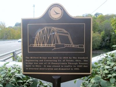
Milford Bridge Marker image. Click for full size.
Photographed By Rev. Ronald Irick, October 13, 2014
1. Milford Bridge Marker
close up of marker
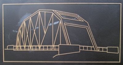
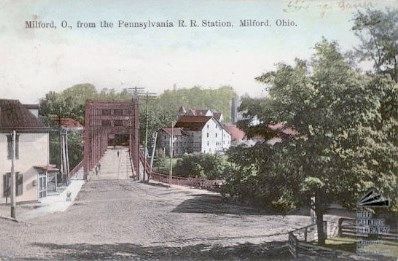
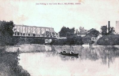
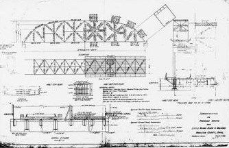
Inscription. The Milford Bridge was built in 1924 by the Standard Bridge Engineering and Constructing Co. of Toledo, Ohio. The bridge was one of 19 Pennsylvania Through Trusses built in Ohio. It was closed to traffic in 1985 due to structural deterioration and dismantled in 1992.
 
Erected by Ohio Department of Transportation.
 
Topics. This historical marker is listed in these topic lists: Bridges & ViaductsRoads & Vehicles. A significant historical year for this entry is 1924.
 
Location. 39° 10.326′ N, 84° 17.874′ W. Marker is in Milford, Ohio, in Clermont County. Marker is on Water Street (U.S. 50) ¼ mile east of St Rt 126 (Ohio Route 126), on the right when traveling west. marker is at the east end of the bridge, on the north side of US 50, at the Little Miami River. St Rt 126 intersects at the west end. marker is accessible from a small parking lot in front of an adjacent business. There is no parking on US 50. Touch for map. Marker is at or near this postal address: 19 Water St, Milford OH 45150, United States of America. Touch for directions.
 
Other nearby markers. At least 8 other markers are within 2 miles of this marker, measured as the crow flies. Milford (about 700 feet away, measured in a direct line); Covalt Station (approx. half a mile away); First Methodist Church (approx. half a mile away); Promont (approx.
Paid Advertisement
Click on the ad for more information.
Please report objectionable advertising to the Editor.
Click or scan to see
this page online
1.1 miles away); Henry Clark Corbin (approx. 1.1 miles away); Milford GAR Veterans Memorial (approx. 1.1 miles away); Greenlawn Cemetery (approx. 1.2 miles away); Camp Dennison (approx. 1.2 miles away). Touch for a list and map of all markers in Milford.
 
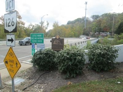
Milford Bridge Site image. Click for full size.
Photographed By Rev. Ronald Irick, October 13, 2014
2. Milford Bridge Site
marker at east end of modern replacement bridge carrying US 50 over the Little Miami River
Milford Bridge Marker image. Click for full size.
Photographed By Rev. Ronald Irick, October 13, 2014
3. Milford Bridge Marker
artwork on the marker
Milford Bridge image. Click for full size.
American Historic Engineering file photo
4. Milford Bridge
Old Milford Bridge image. Click for full size.
Photographed By Old Post Card, March 21, 2003
5. Old Milford Bridge
the old Milford Bridge carried the traction line tracks over the Little Miami River
old Milford Bridge image. Click for full size.
Photographed By Another Old Post Card
6. old Milford Bridge
from the Little Miami River
Milford Bridge plans image. Click for full size.
Amrican Historic Engineering files
7. Milford Bridge plans
 
 
Credits. This page was last revised on August 28, 2022. It was originally submitted on November 19, 2014, by Rev. Ronald Irick of West Liberty, Ohio. This page has been viewed 768 times since then and 68 times this year. Photos:   1, 2, 3, 4, 5, 6, 7. submitted on November 19, 2014, by Rev. Ronald Irick of West Liberty, Ohio. • Al Wolf was the editor who published this page.
Share this page.  
Share on Tumblr
m=79004

CeraNet Cloud Computing sponsors the Historical Marker Database.
This website earns income from purchases you make after using our links to Amazon.com. We appreciate your support.
Paid Advertisement
May. 4, 2024