Near Mammoth Cave in Edmonson County, Kentucky — The American South (East South Central)
The Trestle and the Highway
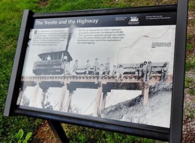
Most of Mammoth Cave National Park’s landscape is an upland plateau dissected by deep, dry valleys. Here, Doyle Valley posed a significant challenge to the Mammoth Cave Railroad. In 1886 a trestle leveled the grade. Today the park roadway is built on fill, reducing the steepness of the valley.
In 1931, the Mammoth Cave Park Commission acquired the Mammoth Cave Railroad for $5,000. The locomotives, equipment and rails were sold for scrap. The trestle remained until 1961, when it was demolished to make way for the construction of the current highway.
Erected by National Park Service, U.S. Department of the Interior.
Topics. This historical marker is listed in these topic lists: Bridges & Viaducts • Railroads & Streetcars • Roads & Vehicles. A significant historical year for this entry is 1886.
Location. 37° 9.872′ N, 86° 5.524′ W. Marker is near Mammoth Cave, Kentucky, in Edmonson County. Marker is on Mammoth Cave Parkway, 0.8 miles north of Kentucky Route 70, on the left when traveling north. Marker is within Mammoth Cave National park, along the Mammoth Cave Railroad Trail. This 9-mile bicycle and hiking recreational trail follows the old Mammoth Cave Railroad bed. Touch for map. Marker is in this post office area: Mammoth Cave KY 42259, United States of America. Touch for directions.
Other nearby markers. At least 8 other markers are within 2 miles of this marker, measured as the crow flies. Mammoth Cave Railroad Bike & Hike Trail (approx. one mile away); The Forest Returns (approx. 1.2 miles away); Engine No. 4 (approx. 1.4 miles away); The Mammoth Cave Railroad (approx. 1.4 miles away); World Treasure Saved (approx. 1.6 miles away); Old Guide's Cemetery (approx. 1.6 miles away); Mammoth Cave National Park (approx. 1.6 miles away); Stephen Tyng Mather (approx. 1.7 miles away). Touch for a list and map of all markers in Mammoth Cave.
Related markers. Click here for a list of markers that are related to this marker. The Mammoth Cave Railroad (1886-1931)
Credits. This page was last revised on September 17, 2020. It was originally submitted on November 28, 2014, by Cosmos Mariner of Cape Canaveral, Florida. This page has been viewed 491 times since then and 13 times this year. Last updated on December 1, 2014, by Cosmos Mariner of Cape Canaveral, Florida. Photos: 1. submitted on November 28, 2014, by Cosmos Mariner of Cape Canaveral, Florida. 2. submitted on August 18, 2020, by Cosmos Mariner of Cape Canaveral, Florida. • Bill Pfingsten was the editor who published this page.

