Louisville in St. Lawrence County, New York — The American Northeast (Mid-Atlantic)
Wilson Hill Wildlife Management Area
Important Habitat Complex
— Natural History —
Inscription.
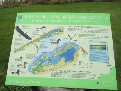
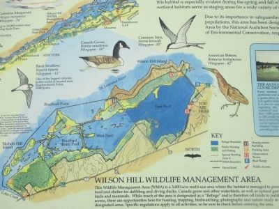
This Wildlife Management Area (WMA) is a 3,400 acre multi-use area where the habitat is managed to provide food and shelter for dabbling and diving ducks, Canada geese and other waterbirds, as well as upland game birds and mammals. While much of the area is designated as a "Refuge" and is therefore off limits to public access, there are opportunities here for hunting, trapping, birdwatching, photography and nature study in designated areas. Specific regulations apply to all activities, so be sure to check before entering the area.
The Lower Saint Lawrence River
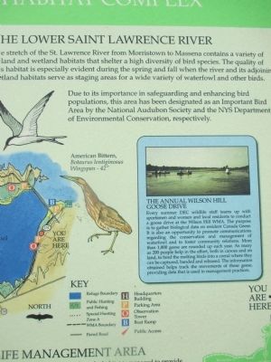
The stretch of the St. Lawrence River from Morristown to Massena contains a variety of upland and wetlands habitats that shelter a high diversity of bird species. The quality of this habitat is especially evident during the spring and fall when the river and its adjoining wetland habitats serve as staging areas for a wide variety of waterfowl and other birds.
Due to its importance in safeguarding and enhancing bird populations, this area has been designated as an Important Bird Area by the National Audubon Society and the NYS Department of Environmental Conservation, respectively.
The Lower St. Lawrence Important Bird Area (IBA)
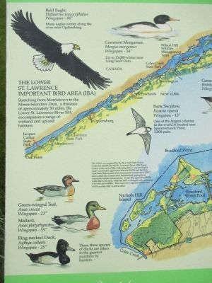
Stretching from Morristown to the Moses-Saunders Dam, a distance of approximately 50 miles, the Lower St. Lawrence River IBA encompasses a range of wetland and upland habitats.
Bald Eagle, Haliaeetus leucocephalus, Wingspan-80". Many eagles winter along the river near Ogdensburg.
Common Merganser, Mergus merganser, Wingspan-34". Up to 10,000 winter near Long Sault Dam.
Bank Swallow, Riparia riparia, Wingspan-13". One of the largest colonies in the world is located near Sparrowhawk Point, 3,000 pairs.
Canada Goose, Branta canadensis, Wingspan-60"
Common Tern, Sterna hirundo, Wingspan-30".
American Bittern, Botaurus lentiginosus, Wingspan-42".
The WMA was acquired by the New York State Power Authority (NYPA) for the St. Lawrence FDR Power Project in the early 1950s. Following that, it as developed under cooperative agreement between NYPA and the New York State Department of Environmental Conservation (DEC)(then called the Conservation Department), primarily for waterfowl habitat enhancement. Under this agreement NYPA holds title to the land, while DEC is charged with managing it for fish and wildlife. This cooperative agreement between NYPA and DEC is still in effect.
These three species of duck are taken by hunters in the greatest numbers.
Green-winged Teal, Anas crecca, Wingspan-23"
Mallard, Anas platyrhynchos, Wingspan-35".
Ring-necked Duck, Aythya collaris, Wingspan-25".
The Annual Wilson Hill Goose Drive
Every summer DEC wildlife staff teams up with sportsmen and women and local residents to conduct a goose drive at the Wilson Hill WMA. The purpose is to gather biological data on resident Canada Geese. It is also an opportunity to promote communications regarding the conservation and management of waterfowl and to foster community relations. More than 1,000 geese are rounded up each year. As many as 200 people help in the effort, both in canoes and on land, to herd the molting birds into a corral where they can be captured, banded and released. The information obtained helps track the movements of these geese, providing data that is used in management practices.
Recreation opportunities related to wildlife are abundant and varied along the Seaway Trail.
Seaway Trail, Inc., Corner Ray & West Main St., Sackets Harbor, NY 13685. 1-800-SEAWAY-T. America's Byways. This exhibit made possible by a grant from FHWA to Seaway Trail, Inc.
Topics and series. This historical marker is listed in these topic lists: Animals • Environment. In addition, it is included in the Great Lakes Seaway Trail National Scenic Byway series list.
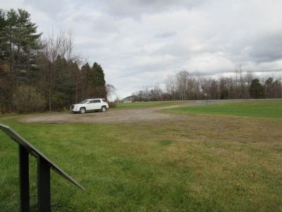
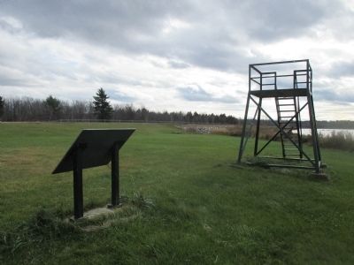
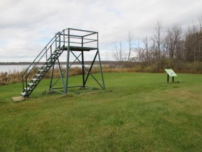
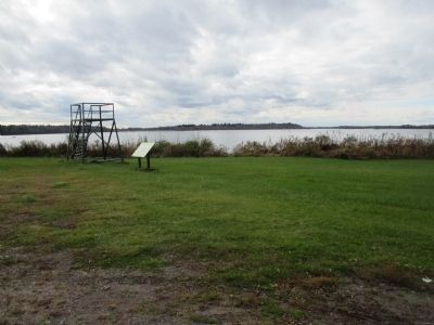
Location. 44° 55.328′ N, 75° 0.922′ W. Marker is in Louisville, New York, in St. Lawrence County. Marker is on New York State Route 131, 0.2 miles west of Willard Road. Marker is on the north side of NY 131 between Willard Road and NY 37. It is at a small parking area and small birdwatching perch. Touch for map. Marker is in this post office area: Massena NY 13662, United States of America. Touch for directions.
Other nearby markers. At least 8 other markers are within 6 kilometers of this marker, measured as the crow flies. St. Lawrence River and Massena (approx. 1.3 miles away); Battle of Crysler’s Farm (approx. 3 miles away in Canada); Battle of Crysler’s Farm 1813 (approx. 4.9 kilometers away in Canada); Battlefield of Crysler’s Farm (approx. 5 kilometers away in Canada); Loyalist American Regiments / Loyalists of the Indian Nations / Sir John Johnson (approx. 5 kilometers away in Canada); Holstein Friesian Cattle in Ontario (approx. 5 kilometers away in Canada); George H. Challies (approx. 5.4 kilometers away in Canada); Aultsville (approx. 6 kilometers away in Canada).
Also see . . . Wilson Hill - New York State Department of Environmental Conservation (DEC). (Submitted on December 3, 2014, by Anton Schwarzmueller of Wilson, New York.)
Credits. This page was last revised on June 16, 2016. It was originally submitted on December 2, 2014, by Anton Schwarzmueller of Wilson, New York. This page has been viewed 625 times since then and 32 times this year. Photos: 1. submitted on December 2, 2014, by Anton Schwarzmueller of Wilson, New York. 2, 3, 4, 5, 6, 7, 8. submitted on December 3, 2014, by Anton Schwarzmueller of Wilson, New York. • Bill Pfingsten was the editor who published this page.
