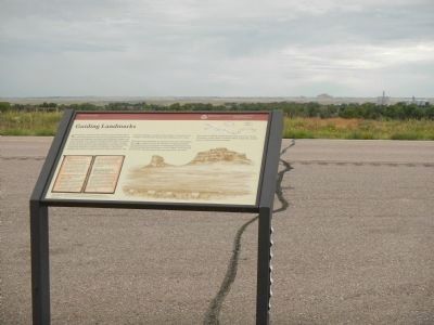
Near Bridgeport in Morrill County, Nebraska — The American Midwest (Upper Plains)
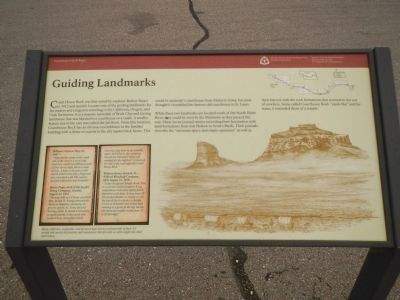
Guiding Landmarks
Courthouse and Jail Rocks
While these two landmarks are located south of the North Platte River, they could be seen by the Mormons as they passed this way. Many wrote journal entries recording their fascination with land formations from Ash Hollow to Scott’s Bluffs. Their journals described the “awesome space and empty openness” as well as their interest with the rock formations that seemed to rise out of nowhere. Some called Courthouse Rock “castle like” and for some, it reminded them of a temple.
Side bar, lower right:
William Clayton, May 24, 1847 - “Opposite the camp on the south side of the river is a very large rock very much resembling a castle of four stories high, but in a state of ruin. A little to the east a rock stands which looks like a fragment of a very thick wall. The scenery around is pleasant and romantic.”
Henry Pugh, clerk of the Joseph Young Company, Sunday, August 21, 1853 “Meeting held at 1:15 p.m. at which Pres. Joseph W. Young exhorted the Saints to diligence, constancy in prayer, union, etc. Some discord having existed, he found it necessary to speak plainly to the camp and scold them somewhat which, however, was done in an amiable spirit. At 4:45 p.m. the company moved on, traveling 5 miles and camped for the night at 7 o’clock on the side of the road opposite Court House Rock.”
William Henry Branch, Sr. - Wilford Woodruff Company, Mon. August 12, 1850 - “Today we passed Temple Rock, This is a curious work of nature. It is a stupendous rock some eighty feet in diameter at its base. It rises some 40 feet perpendicular, or nearly so. On the top of this is a dome or steeple 15 feet in diameter and 20 feet high running to a point at the top. Beside this there are smaller rocks from 15 to 20 feet high.”
Many explorers, emigrants and pioneers kept diaries and journals of their 4-5 month trek across the prairies and mountains that provide us with insight into their experiences.
Erected by Mormon Trail Heritage
Foundation & National Park Service.
Topics and series. This historical marker is listed in these topic lists: Roads & Vehicles • Settlements & Settlers. In addition, it is included in the Mormon Pioneer Trail series list. A significant historical date for this entry is May 24, 1847.
Location. 41° 39.953′ N, 103° 3.417′ W. Marker is near Bridgeport, Nebraska, in Morrill County. Marker is on Route 26 near Road 103, on the right when traveling west. Touch for map. Marker is in this post office area: Bridgeport NE 69336, United States of America. Touch for directions.
Other nearby markers. At least 8 other markers are within 5 miles of this marker, measured as the crow flies. Dedicated to the Early Pioneers (approx. 2.2 miles away); Mormon Pioneer Camp (approx. 2.2 miles away); Bridgeport, Nebraska (approx. 2.2 miles away); Oregon Trail (approx. 2.3 miles away); Amanda Lamme (approx. 4.6 miles away); Dedicated to the Unknown Soldier (approx. 4.6 miles away); a different marker also named Oregon Trail (approx. 4.6 miles away); Courthouse and Jail Rocks (approx. 5 miles away). Touch for a list and map of all markers in Bridgeport.
Additional keywords. Mormon Trail
Credits. This page was last revised on June 16, 2016. It was originally submitted on December 5, 2014, by Barry Swackhamer of Brentwood, California. This page has been viewed 641 times since then and 15 times this year. Photos: 1, 2. submitted on December 5, 2014, by Barry Swackhamer of Brentwood, California. • Bill Pfingsten was the editor who published this page.

