Near Fredericksburg in Spotsylvania County, Virginia — The American South (Mid-Atlantic)
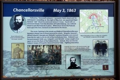
Chancellorsville
May 3, 1863
The acute fighting in the woods and fields of Chancellorsville soon became a steady roar as Stuart pressed his attack. Brigadier General’s Alfred Colquitt’s Georgia and Nicholls’ Louisiana Brigades were moved from the far right to the far left of the Confederate lines. Ordered to go forward around 10:00 a.m. Colquitt’s and Nicholls’ troops sought once again to turn the flank of the Federal forces. Instead, they ran into the Federal troops of Brigadier General Erasmus Tyler. Fighting intensified.
(captions)
(upper left) Stuart followed Lee’s orders to the limit urging his troops onward.
(lower left) Amongst the killed was Private Issac Barnes, 91st PA infantry. He was 19 years of age.
(lower center) Famed artist Robert Knox drew this watercolor of the heavy fighting at Chancellorsville in 1863. These vivid colors and action scenes were very popular with the public.
(upper right) Map of the battle at 10 a.m. on May 3rd. Colquitt’s and Nicholls’ troops are at the far right.
(lower right) Corporal Isaac Reeves, left, and his brother, Sgt. James Reeves, Co. K, 10th La. Infantry. Sadly, Isaac was killed in action at Gettysburg and James was killed in action at Chancellorsville, Virginia.
(lower right) Colonel Jacob Frick, 126th Pennsylvania Infantry was awarded a Congressional Medal of Honor for personally re-capturing the flags of his regiment during the heated fighting in the woods.
Images courtesy S.H.A.-M.H.I.-V.H.S.-Library of Congress-Tintypes of Reeves’ brother courtesy Mrs. Anna Belle Reeves Morris-2014
Erected 2014.
Topics. This historical marker is listed in this topic list: War, US Civil. A significant historical date for this entry is May 2, 1822.
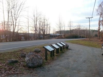
Location. 38° 19.375′ N, 77° 38.709′ W. Marker is near Fredericksburg, Virginia, in Spotsylvania County. Marker is on Elys Ford Road (County Route 610) 0.4 miles north of US Ford Road (County Route 616), on the right when traveling north. Touch for map. Marker is at or near this postal address: 13414 5th Corps Ln, Fredericksburg VA 22407, United States of America. Touch for directions.
Other nearby markers. At least 8 other markers are within walking distance of this marker. Colquitt’s Attack (here, next to this marker); Colquitt Turns Tyler’s Flank (a few steps from this marker); Tyler’s Withdrawal To This Line (a few steps from this marker); Stone's Reconnaissance (approx. 0.3 miles away); A Midnight Conference (approx. 0.4 miles away); Union Line Contained Along Mineral Springs Road (approx. 0.4 miles away); The 124th New York Regiment’s First Battle (approx. 0.4 miles away); Apex of Hooker’s Last Line (approx. 0.6 miles away). Touch for a list and map of all markers in Fredericksburg.
Also see . . . Fredericksburg & Spotsylvania National Military Park. National Park Service (Submitted on December 14, 2014.)
Credits. This page was last revised on February 2, 2023. It was originally submitted on December 14, 2014, by Bernard Fisher of Richmond, Virginia. This page has been viewed 511 times since then and 41 times this year. Photos: 1, 2, 3. submitted on December 14, 2014, by Bernard Fisher of Richmond, Virginia.


