Louisbourg in Cape Breton Region, Nova Scotia — The Atlantic Provinces (North America)
First Lighthouse
Le premier phare
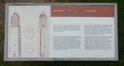
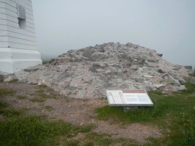
Here are the ruins of Louisbourg’s first light, the earliest to be erected in Canada and the second in North America. Lit in 1734, it was badly damaged in a fire two years later, then quickly repaired. The replacement lantern was designed to be fireproof, thick brick vaults, a lead-sheathed roof, and a water cooled oil lamp.
Until the siege of Louisbourg in 1758, this harbour was one of the busiest in the New World, with the lighthouse offering guidance to thousands of approaching mariners. The operating costs of the service, including the keeper’s salary, were paid for from a toll levied on incoming vessels. After 1758, however, the lighthouse was probably no longer used. It is shown in ruins on a 1798 plan. When the present light was being constructed, during the 1920s, local historical enthusiasts lobbied to have the ruins preserved. In 1926 the Historic Site and Monuments Board of Canada unveiled the bronze plaque to your left.
French:
Voici les vestiges du premier phare de Louisbourg, qui était également le premier phare érigé au Canada et le deuxième en Amérique du Nord. Mis en service en 1734, il fut grandement endommagé par un incendie deux ans plus tard, mais rapidement remis en état. Cette lanterne de rechange avait été conçue pour résister au feu, grâce à sa voûte de briques, à son toit plombé et a un système de refroidissement hydraulique de la lampe à huile de morue.
Jusqu’au siege de 1758, le port de Louisbourg fut un des plus achalandés du Nouveau Monde. Le phare guidait l’approche de milliers de marins. Les frais de son exploitation, y compris le salaire du gardien, étaient recouvrés au moyen d’un droit imposé aux navires entrants. Après 1758, on cessa d’utiliser le phare. Un plan de 1798 en montre les ruines. Lors de la construction du phare actuel, dans les années 1920, des passionnés d’histoire locale firent pression sur les autorités pour qu’elles préservent ces ruines. En 1926, la Commission des lieux et monuments historiques du Canada a inauguré la plaque que vous voyez à votre gauche.
Erected by Parks Canada.
Topics and series. This historical marker is listed in these topic lists: Communications • Waterways & Vessels. In addition, it is included in the Lighthouses series list. A significant historical year for this entry is 1734.
Location. 45° 54.395′ N, 59° 57.505′ W. Marker is in Louisbourg, Nova Scotia, in Cape Breton Region. Marker can be reached from Havenside Road, on the left when traveling east. Touch for map. Marker is at or near this postal address: 573 Havenside Road, Louisbourg NS B1C 1P4, Canada. Touch for directions.
Other nearby markers. At least 8 other markers are within 3 kilometers of this marker, measured as the crow flies. First Lighthouse Tower (here, next to this marker); French Garrison at Louisbourg (here, next to this marker); 19th-Century Lighthouse (a few steps from this marker); Louisbourg Harbour (within shouting distance of this marker); Lighthouse Point (within shouting distance of this marker); Kennelly Point (about 120 meters away, measured in a direct line); The Lobster Fishery (approx. 0.6 kilometers away); Fortress of Louisbourg (approx. 2 kilometers away). Touch for a list and map of all markers in Louisbourg.
More about this marker. This marker is near the lighthouse located at the end of Havenside Road.
Credits. This page was last revised on November 27, 2019. It was originally submitted on December 29, 2014, by Barry Swackhamer of Brentwood, California. This page has been viewed 415 times since then and 15 times this year. Last updated on November 26, 2019, by Steve Stoessel of Niskayuna, New York. Photos: 1, 2. submitted on December 29, 2014, by Barry Swackhamer of Brentwood, California.

