Norden in Nevada County, California — The American West (Pacific Coastal)
Tunnel 6
Hwy 40 Scenic Bypass
History 1866 - Right here
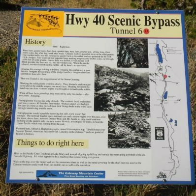
Bam, bam, quarter turn; Bam, bam, quarter turn; Bam, bam, quarter turn; all day long, three shifts a day, day after day, week after week. Chinese workers pounded away at the solid granite. One worker held a star bit, turning it a quarter turn as two other workers pounded the bit with 18 lb. sledges. Four teams at four separate faces making progress only inches a day, cutting through 1659 feet of solid granite. Once a hole was drilled, it was packed with black powder, the fuse was set, and the workers ran. When the smoke cleared, workers hauled out the rubble — all by hand — no machines.
Imagine the courage holding the drill bit. Imagine the confidence in your friends. Imagine the accuracy of the sledge handlers; imagine their concentration, hour after hour.
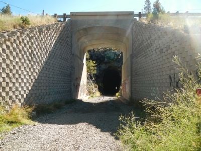
That was Tunnel 6, the longest tunnel of the Sierra Crossing.
Working the solid granite went too slowly. They blasted a shaft straight down above the middle to open two more faces. Hauling the rubble by hand was too slow. A steam engine was brought in to haul up the rubble.
When all four faces joined up, they were off by only two inches — after two years. Amazing.
Facing granite was not the only obstacle. The workers faced avalanches and heavy snows: 40 feet that first winter. Workers didnít see daylight for days at a time as they moved from their living sheds to work faces through tunnels dug into the snow.
Nitroglycerine would speed the tunneling but still, work wasnít fast enough. The railroad hauled track, railroad cars and a steam engine over the pass, over the snow, above here, between Donner Peak and Mt. Judah, so they could continue building on the eastern side — to race across Nevada, to earn pay for miles, to beat the Union Pacific which was coming from the east.
Pictured here, Alfred A. Hart photographs: tunnel 6 incomplete top, “Shaft House over Summit Tunnel, American Peak (now Mt. Lincoln) in the distance,” and east portal of Tunnel 6, bottom.
Things to do right here
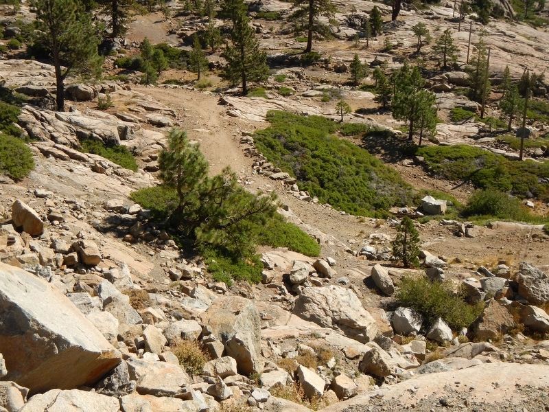
Hike to the Pacific Crest Trailhead at Lake Mary and instead of going up hill try and retrace the route going downhill of the old Lincoln Highway. Itís what appears to be a roadway that is now being overgrown.
Walk on the top, over the tunnel and see the monument there as well as the metal covering for the shaft that was used so the Chinese workers could work from the middle out as well as the outside in.
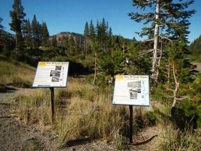
Erected by Donner Summit Historical Society. (Marker Number 23.)
Topics and series. This historical marker is listed in these topic lists: Asian Americans • Roads & Vehicles. In addition, it is included in the Donner Summit Historical Society, and the Nevada - 20-Mile Museum - Hwy 40 Scenic Bypass series lists. A significant historical year for this entry is 1866.
Location. 39° 19.022′ N, 120° 19.789′ W. Marker is in Norden, California, in Nevada County. Marker is on Sugar Bowl Road near Donner Pass Road, on the right when traveling south. Touch for map. Marker is in this post office area: Norden CA 95724, United States of America. Touch for directions.
Other nearby markers. At least 8 other markers are within walking distance of this marker. Summit Hotel (here, next to this marker); Donner Ski Ranch (about 500 feet away, measured in a direct line); Donner Pass Airway Station & Beacon (approx. 0.2 miles away); Sugar Bowl Academy (approx. 0.2 miles away); Great Summit Tunnel of the Sierra Nevada (approx. 0.2 miles away); Sacred Symbols From Ancient Times (approx. half a mile away); Petroglyphs (approx. half a mile away); China Wall (approx. half a mile away). Touch for a list and map of all markers in Norden.
More about this marker. This marker is removed every Fall for the winter months and replaced every Spring for the summer season.
Also see . . .
1. The 20-Mile Museum Brochure. Information and the listing of all the markers within this series. (Submitted on March 28, 2015.)
2. Tunnel 6 - The Building. An article by the Donner Summit Historical Society detailing the building of Tunnel 6 (Submitted on March 28, 2015.)
Credits. This page was last revised on October 22, 2020. It was originally submitted on March 24, 2015, by Barry Swackhamer of Brentwood, California. This page has been viewed 575 times since then and 14 times this year. Photos: 1, 2, 3. submitted on March 24, 2015, by Barry Swackhamer of Brentwood, California. 4. submitted on October 22, 2020. • Syd Whittle was the editor who published this page.
Editor’s want-list for this marker. Photo of the monument on top of the tunnel. Photos of the old Lincoln Highway mentioned in marker text. • Can you help?


