Stony Point in Rockland County, New York — The American Northeast (Mid-Atlantic)
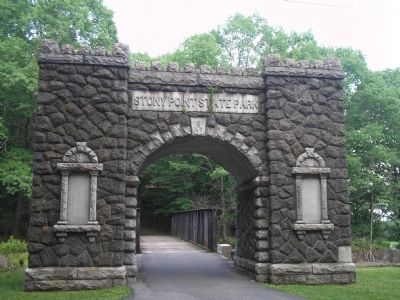
Stony Point State Park
Inscription.
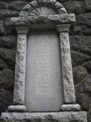
Left Tablet:
A British Outpost
commanding the King’s Ferry
Assaulted and taken
July 15-16, 1779
by the Corps of light infantry
commanded by
Anthony Wayne
Renamed Fort Wayne
Acquired by the State of New York
1897
The American Scenic and Historic
Preservation Society
custodians.
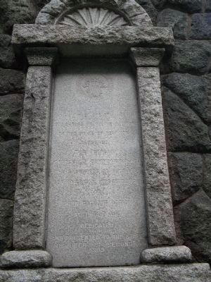
Right Tablet:
The Society Daughters of the Revolution of the State of New York erected this gateway gratefully commemorating the sacrifices of patriots for American Independence and their gallant action at this place Dedicated and presented to the State October second 1909
Erected 1909 by The Society Daughters of the Revolution of the State of New York.
Topics. This historical marker is listed in these topic lists: Military • Notable Events • War, US Revolutionary. A significant historical month for this entry is July 1787.
Location. 41° 14.463′ N, 73° 58.614′ W. Marker is in Stony Point, New York, in Rockland County. Marker is on Battlefield Road when traveling east. Touch for map. Marker is in this post office area: Stony Point NY 10980, United States of America. Touch for directions.
Other nearby markers. At least 8 other markers are within walking distance of this marker. Stony Point Battlefield State Historic Site (about 400 feet away, measured in a direct line); British Defenses: The Outer Works (about 500 feet away); "I … imagined them to be British Troops, but found my mistake by being wounded and taken prisoner." (about 500 feet away); The American Strategy (about 600 feet away); 17th British Regiment of Foot (about 600 feet away); Stony Point Battlefield (about 600 feet away); Capture of Stony Point (about 600 feet away); The British Occupy Stony Point (about 700 feet away). Touch for a list and map of all markers in Stony Point.
Related markers. Click here for a list of markers that are related to this marker. This series of markers follow the walking tour of the Stony Point Battlefield.
Also see . . . The Battle of Stoney (sic) Point. The American Revolutionary War website entry (Submitted on June 9, 2008, by Bill Coughlin of Woodland Park, New Jersey.)
Credits. This page was last revised on August 23, 2021. It was originally submitted on June 9, 2008, by Bill Coughlin of Woodland Park, New Jersey. This page has been viewed 1,110 times since then and 17 times this year. Photos: 1, 2, 3. submitted on June 9, 2008, by Bill Coughlin of Woodland Park, New Jersey.


