Great Falls in Cascade County, Montana — The American West (Mountains)
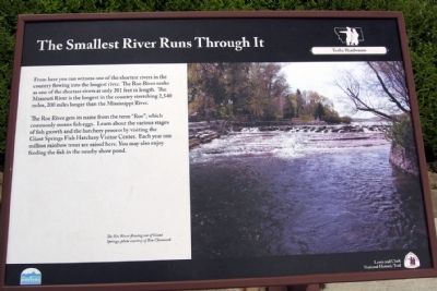
The Smallest River Runs Through It
The Roe River gets its name from the term “Roe”, which commonly means fish eggs. Learn about the various stages of fish growth and the hatchery process by visiting Giant Springs Fish Hatchery Visitor Center. Each year one million rainbow trout are raised here. You may also enjoy feeding the fish in the nearby show pond.
(Photo caption)
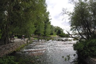
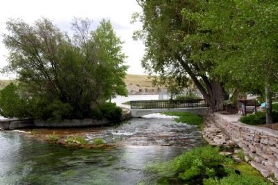
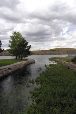
The Roe River flowing out of Giant Springs, photo courtesy of Ben Chovanak
Erected by Montana State Parks.
Topics. This historical marker is listed in this topic list: Natural Features.
Location. 47° 32.078′ N, 111° 13.779′ W. Marker is in Great Falls, Montana, in Cascade County. Marker can be reached from Giant Springs Road, 1.3 miles north of River Drive North. Marker is located in Giant Springs State Park; the above directions are to the main driveway to the park. Touch for map. Marker is at or near this postal address: 4803 Giant Springs Rd, Great Falls MT 59405, United States of America. Touch for directions.
Other nearby markers. At least 8 other markers are within walking distance of this marker. Where Does the Water Come From? (a few steps from this marker); These Springs Have Witnessed... (within shouting distance of this marker); Pure Springs Along the Missouri River (within shouting distance of this marker); Giant Fountain (within shouting distance of this marker); Of Special Concern (approx. ¼ mile away); One of Many Firsts (approx. ¼ mile away); The Army's Navy (approx. 0.4 miles away); A "great" Set of Falls (approx. 0.4 miles away). Touch for a list and map of all markers in Great Falls.
More about this marker. The marker is an interpretive sign that is part of the Lewis and Clark National Historic Trail.
Also see . . .
1. Giant Springs State Park. From the official Montana State Parks website. (Submitted on April 29, 2015.)
2. Roe River - Wikipedia entry. (Submitted on April 29, 2015.)
Credits. This page was last revised on June 16, 2016. It was originally submitted on April 29, 2015, by Duane Hall of Abilene, Texas. This page has been viewed 417 times since then and 17 times this year. Photos: 1, 2, 3, 4. submitted on April 29, 2015, by Duane Hall of Abilene, Texas.
Editor’s want-list for this marker. Photo of wide-view of marker and surrounding area. Photos and entries for the many other markers in the park. • Can you help?


