Austin in Travis County, Texas — The American South (West South Central)
The Caldwell Treaty Oak Park
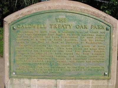
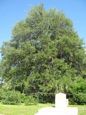
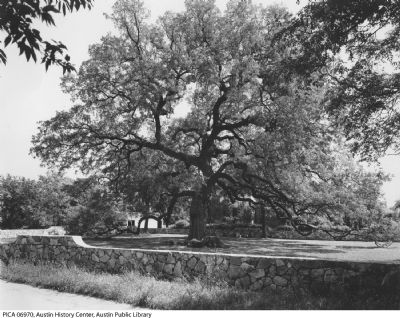
Estimated to have been a majestic tree of about 100 years when Columbus first landed on North American shores, this live oak tree has been pronounced the most perfect specimen of a tree in North America, and its picture hangs in the Hall of Fame of Forestry at Washington.
Formerly standing as the center of a group of trees called "The Council Oaks," this tree takes its name from its role in the history of the Lone Star State. Stephen F. Austin is reputed to have signed the first boundary line agreement between Indians and whites under the canopy of its branches; battles and important conferences have been planned, pacts signed, and feasts and religious ceremonies celebrated in its shade.
The Treaty Oak was purchased by the City of Austin in 1937 to stand as a living and fitting symbol of the mighty state it has watched develop.
Topics and series. This historical marker is listed in these topic lists: Horticulture & Forestry • Native Americans • Settlements & Settlers. In addition, it is included in the Historic Trees series list. A significant historical year for this entry is 1937.
Location. 30° 16.277′ N, 97° 45.339′ W. Marker is in Austin, Texas, in Travis County. Marker is at the intersection of Baylor Street and Sayers Street, on the right when traveling north on Baylor Street. Touch for map. Marker is at or near this postal address: 507 Baylor Street, Austin TX 78703, United States of America. Touch for directions.
Other nearby markers. At least 8 other markers are within walking distance of this marker. Las Ventanas (approx. 0.2 miles away); Wood Street Settlement at Shoal Creek (approx. ¼ mile away); The William Green Hill House (approx. 0.3 miles away); Family Home of Dr. R. K. Smoot (approx. 0.3 miles away); TMI Castle (approx. 0.4 miles away); Robinson-Macken House (approx. 0.4 miles away); Seaholm Power Plant (approx. 0.4 miles away); Joseph and Mary Robinson Martin House (approx. 0.4 miles away). Touch for a list and map of all markers in Austin.
Credits. This page was last revised on February 1, 2023. It was originally submitted on May 3, 2015, by Richard Denney of Austin, Texas. This page has been viewed 746 times since then and 48 times this year. Photos: 1, 2, 3. submitted on May 3, 2015, by Richard Denney of Austin, Texas. • Bernard Fisher was the editor who published this page.


