Near New Market in Shenandoah County, Virginia — The American South (Mid-Atlantic)
DuPont at Rude’s Hill
“I had to depend entirely upon myself…”
— 1864 Valley Campaign —
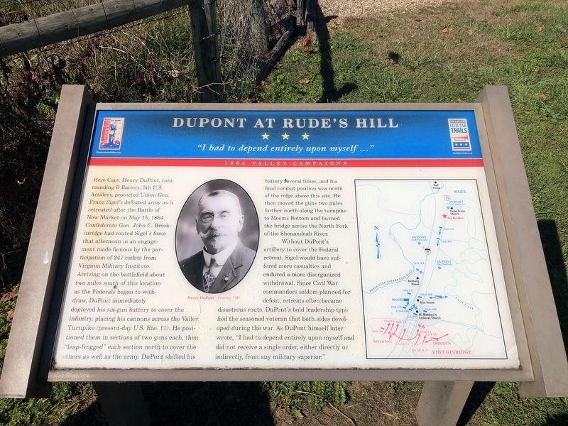
Here Capt. Henry DuPont, commanding B Battery, 5th U.S. Artillery, protected Union Gen. Franz Sigel’s defeated army as it retreated after the Battle of New Market on May 15, 1864. Confederate Gen. John C. Breckinridge had routed Sigel’s force that afternoon in an engagement made famous by the participation of 247 cadets from Virginia Military Institute. Arriving on the battlefield about two miles south of this location as the Federals began to withdraw, DuPont immediately deployed his six-gun battery to cover the infantry, placing his cannons across the Valley Turnpike (present-day U.S. Rte. 11). He positioned them in sections of two guns each, then “leap-frogged” each section north to cover the others as well as the army. DuPont shifted his battery several times, and his final combat position was north of the ridge above this site. He then moved the guns two miles farther north along the turnpike to Meems Bottom and burned the bridge across the North Fork of the Shenandoah River.
Without DuPont’s artillery to cover the Federal retreat, Sigel would have suffered more casualties and endured a more disorganized withdrawal. Since Civil War commanders seldom planned for defeat, retreats often became disastrous routs. DuPont’s bold leadership typified the seasoned veteran that both sides developed during the war. As DuPont himself later wrote, “I had to depend entirely upon myself and did not receive a single order, either directly or indirectly, from any military superior.”
Erected by Virginia Civil War Trails.
Topics and series. This historical marker is listed in this topic list: War, US Civil. In addition, it is included in the Virginia Civil War Trails series list. A significant historical month for this entry is May 1864.
Location. 38° 41.57′ N, 78° 38.998′ W. Marker is near New Market, Virginia, in Shenandoah County. Marker is on Old Valley Pike (U.S. 11) south of Smith Creek Road (Local Route 620), on the right when traveling south. Touch for map. Marker is in this post office area: New Market VA 22844, United States of America. Touch for directions.
Other nearby markers. At least 8 other markers are within walking distance of this marker. The Summers & Koontz Executions (here, next to this marker); Post-Appomattox Tragedy (a few steps from this marker); The Post-Appomattox Tragedy Monument (within shouting distance of this marker); Summers & Koontz Monument (within shouting distance of this marker); In Memory of Noah Richard Proctor (about 800 feet away, measured in a direct line); Cavalry Engagement (approx. 0.7 miles away); Rude’s Hill (approx. 0.7 miles away); Rude’s Hill Action (approx. 0.7 miles away). Touch for a list and map of all markers in New Market.

Photographed By Devry Becker Jones (CC0), October 17, 2020
2. DuPont at Rude’s Hill Marker
Unfortunately, the marker has weathered significantly.
Credits. This page was last revised on October 19, 2020. It was originally submitted on January 28, 2007, by J. J. Prats of Powell, Ohio. This page has been viewed 2,837 times since then and 45 times this year. Photos: 1. submitted on January 28, 2007, by J. J. Prats of Powell, Ohio. 2, 3. submitted on October 18, 2020, by Devry Becker Jones of Washington, District of Columbia. 4. submitted on January 28, 2007, by J. J. Prats of Powell, Ohio.


